Last Updated: 18th Nov 2023

Beginner

Save Trail Save

I've done it Done

S2N2S

Riverhead, Auckland

Submitted by Glenn Nicol

Last Updated: 18th Nov 2023

Beginner

Save Trail Save

I've done it Done

Open

Grunt Factor: 21 ?

Gnarl Factor: 4 ?

29.2km

600m

600m

175m


Login as a VIP to see driving directions, distance and time.

Trail Map

Type of Run

Urban fringe

Out and Back

Undulating, small hills only

Dog Friendly

Native bush

Plantation/exotic forest

Run Makeup

100%

Gravel Road

Average Uphill Gradient: +3.9%

Average Downhill Gradient: -4.4%

Trailhead

Login as a VIP to see the trailhead information.

Estimated Times to Run

4:00

Slow

3:00

Moderate

2:00

Fast

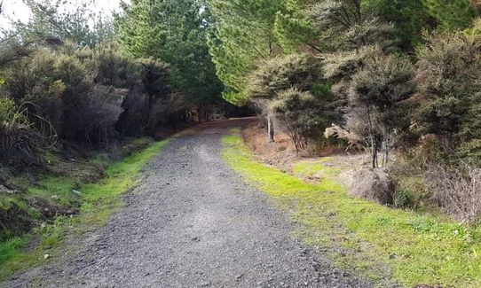
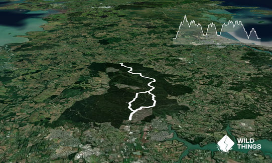
An easy, pleasant run in Riverhead Forest on forestry roads so nothing technical. From start gate follow Long Bush Road for 1km then left up Link Rd then right following Barlow Road until it connects with Long Bush Road around 5km. Follow Long Bush Road (the main road, fairly obvious) until it reaches the intersection with Rahanui Road. Turn right and head north following Rahanui Road to the northern end of the forest, terminating at Bald Hill Road, where there is another entrance gate. Good views north here. Head back south following the same track until the Barlow Road/Long Bush Road intersection. Option to return on same track or take Long Bush Road which returns to the start. To get to 29km turn around at Link Road at the 25km mark and repeat the Long Bush Road climb (1.5km) then back to start.

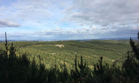
Some nice views to the south east around the 4km mark. Nice farmland views at the northern end of the forest.

If you know of any public toilets near the trail start or on the route, please login and then let us know so we can update this section.

Plenty of parking on gravel road outside gate at northern end of Forestry Road. Can be busy on weekends as numerous groups use the forest for various activities but should always find a park. Public transport on surrounding roads but nothing direct to start.

27 km

24 minutes

Yes

No

Easy.

Generally follows the main road which is obvious as being the widest road. If in doubt follow Long Bush Road. Generally well sign posted.

Generally good.

Short-sleeved thermal top, Windproof jacket, Gloves, Beanie/thermal headwear, Whistle, First aid kit, Extra food for emergencies, Cellphone, Map

Not aware of any options for water.

Can be very dry during summer months, and muddy/slippery during winter and after rain, although the forestry roads are generally fine all year round. Exposed in parts but can easily shelter in the pine trees if needed.

Large trees so avoid in high winds.

Hallertau Brewery
1171 Coatesville-iverhead Highway
http://www.hallertau.co.nz
Great beers, great food, great atmosphere.

Trail Legend

PM

Peter Marek

has completed S2N2S twice in the last year.

Learn about Trail Legends.

You and S2N2S

As a VIP member you can record private notes for this trail, see all of your times and more.

Register Now

Already have an account? Login now

Trail Reviews

Great one for a long run. The road is slanted all the way, which made my ankles complain at the end, but overall not technical.

Jaco Scherman

July 11, 2020

First run out in Riverhead and can see exactly why people keep coming back for more! The run flew by and I didn't want it to be over. You don't realize how much you have been running downhill until the turn around point, a bit slower pace on the return than expected until back at the top again. Looking forward to trying more and more out here soon.

Will Prosor

June 5, 2020

Great place to get some kms in and not busy. Rolling hills. Uncomplicated but watch out for signs, we missed a couple and ended up with a much longer run. Gravel gravel gravel.

Ruth Bell

January 19, 2020

Fantastic all weather course, with plenty of opportunities to increase your distance via other forestry roads.

Matt Rowbotham

August 21, 2019

Login to submit a review

Trail Running Community

Find people who are interested in or have completed this trail run.

You must register or login to view this feature.

Register Now

Overlapping Trails

These overlap with this trail to some degree. You may wish to combine them but please note that to qualify for FKTs on these runs you should record a separate activity for each.

Riverhead Gates Challenge

Riverhead Gates Challenge

Length: 67.0km

Level: Intermediate

Strip Trig to Barlow

Strip Trig to Barlow

Length: 13.5km

Level: Beginner - Intermediate

Other trails nearby
Riverhead Hourglass 10KM

Riverhead Hourglass 10KM

Length: 10.4km

Level: Intermediate

Riverhead Forestry Road 14KM

Riverhead Forestry Road 14KM

Length: 14.4km

Level: Intermediate

Run Forest Run!

Run Forest Run!

Length: 17.7km

Level: Intermediate - Experienced

Find more trails and peaks nearby