Last Updated: 2nd Aug 2024
Grampians - Halls Gap to Borough Huts Campground
Grampians Peaks Trail
Last Updated: 2nd Aug 2024
Open
Grunt Factor: 43 ?
Gnarl Factor: 63 ?
24.3km
1135m
1070m


Last Updated: 2nd Aug 2024
Grampians Peaks Trail
Last Updated: 2nd Aug 2024
Open
Grunt Factor: 43 ?
Gnarl Factor: 63 ?
24.3km
1135m
1070m
Front country - easily accessible
Point to Point (one way)
Undulating, some big hills
Native bush
Lakeside
Open ridges/tops
Moderate Single Track
Technical Single Track
Average Uphill Gradient: +9.6%
Average Downhill Gradient: -9.1%
VIP Feature: Send this route to your Garmin account so you can follow the course on your Garmin device.
Login as a VIP to see the trailhead information.
5:00
Slow
3:30
Moderate
2
Fast
We are eager to expand our Trail Running Directory in Australia. For a limited time, if you submit any trail in Australia and we publish it, we'll double the credit you receive! Submit a new trail now.
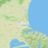
This trail follows the Grampians Peak Trail south from Halls Gap to Borough Huts Campground.
Starting from the turnoff from Grampians Road to Folkes Road in the centre of Halls Gap, follow the markers for the Grampians Peaks Trail heading out of town along Stoney Creek - initially heading west and then following the river as it bends south. The track will turn more and more rocky as you gain height, and from here for most of the rest of the trail you can expect to be rock hopping most of the time.
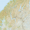
The trail will take you past Wonderland Carpark (do not turn off here) and the Sundial Carpark - if you want to meet up with any support crew helping with the logistics needed on this one-way trail. Make sure to take the turnoff to Pinnacles Viewpoint between the two carparks along the ridge as you gain height and make the ridge proper.
You'll drop down from Sundial Carpark past Bugiga Hiker Camp and cross Silverband Road. From here you will sharply climb up to Mt Rosea before dropping finally to the valley - where you'll find the endpoint at Borough Huts Campground and Grampians Road again. There is a 10km road section which can either be run, hitchhiked or have a transfer with a tour operator.
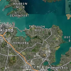
Multiple great viewpoints over Lake Bellfield.
Public toilets are at the campgrounds at Halls Gap, Bugiga and Borough Huts Campgrounds.
Plenty of parking near the trailhead in Halls Gap.
1 minutes
Unknown
No
Moderate.
Make sure to follow the Grampians Peaks Trail markings.
Patchy.
Long-sleeved thermal top, Seam-sealed waterproof jacket, Gloves, Personal Locator Beacon (PLB), Whistle, First aid kit, Extra food for emergencies, Survival blanket, Cellphone, Map, Headtorch and spare batteries
At the campgrounds and at Sundial Campground.
Not recommended in poor weather.
Bushfires, Australian wildlife.
Fastest Known Times (FKTs)
You and Grampians - Halls Gap to Borough Huts Campground
As a VIP member you can record private notes for this trail, see all of your times and more.
Already have an account? Login now
Send to your phone
Scan the below QR code to open this trail on your phone.

Tip: position the QR code in your phone camera screen.