Last Updated: 21st Sep 2023

Intermediate

Save Trail Save

I've done it Done

Moerangi Meander

Murupara, Bay of Plenty

Submitted by Daniel Parkinson

Last Updated: 21st Sep 2023

Intermediate

Save Trail Save

I've done it Done

Open

Grunt Factor: 42 ?

Gnarl Factor: 17 ?

34.1km

1310m

1310m

1000m


Login as a VIP to see driving directions, distance and time.

Trail Map

Type of Run

Front country - easily accessible

Point to Point (one way)

Undulating, small hills only

Native bush

Run Makeup

100%

Easy Single Track

Average Uphill Gradient: +7.9%

Average Downhill Gradient: -8.6%

Trailhead

Login as a VIP to see the trailhead information.

Estimated Times to Run

6:00

Slow

4:30

Moderate

3:00

Fast

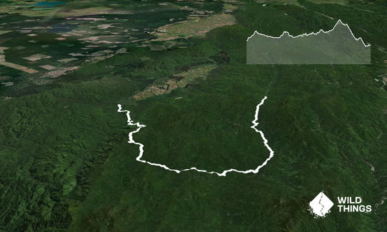
Beautiful, easy single track through stunning native bush. It is a mountain bike trail, and this is described in the recommended direction for mountain biking, so you won't have to watch out for any bikers coming at you from the front. It's a remote and quiet track so bikers should be few and far between, especially outside summer.

If you've been unable to cross the ford (the 34.1km distance includes the 1.5km from the ford to the track start), start by running across it, then following the gravel road for a bit over a kilometre, up a small hill. At the track entrance, follow the trail for 6km or so to Skips Hut. Water is available here.

Continue up a small hill for 6km or so to Rogers Hut. This is a beautiful spot and again water is available here.

After a further 9km of gently undulating trails, you'll come across the turnoff to Moerangi Hut. It's worth the 500m detour (the distance of this trail includes this detour), especially if you need water. Back on the main trail, the main climb of the day begins (over 4km or so), following a fairly gently gradient up to Moerangi.

From here, there's a beautiful 6km descent through stunning native bush. You'll join another track near the bottom, and this is very wide and easy. Cross the bridge over the stunning canyon (be sure to look down at it), and then you're back in the carpark!
If you know of any public toilets near the trail start or on the route, please login and then let us know so we can update this section.

Lots of parking at the both ends, but limited at the Okahu end if you don't have a 4WD - plenty of space along the gravel road. Don't leave valuables in your car - not the safest place in the world, but there should be no problems during the day.

40 km

50 minutes

Unknown

No

Moderate.

Very patchy.

Long-sleeved thermal top, Seam-sealed waterproof jacket, Gloves, Personal Locator Beacon (PLB), Whistle, First aid kit, Extra food for emergencies, Survival bag, Cellphone, Map

Tank water available at all three huts. There are a few small streams in the first 6km, but after this they are scare.

Muddy in winter, but runnable year round.

You and Moerangi Meander

As a VIP member you can record private notes for this trail, see all of your times and more.

Register Now

Already have an account? Login now

Trail Reviews

Be the first to submit a review for Moerangi Meander !

Login to submit a review

Trail Running Community

Find people who are interested in or have completed this trail run.

You must register or login to view this feature.

Register Now

Other trails nearby
Mangamate Loop

Mangamate Loop

Length: 35.5km

Level: Intermediate

Wet Feet

Wet Feet

Length: 20.1km

Level: Intermediate

Find more trails and peaks nearby