Last Updated: 6th Apr 2024
Eliza Mine Climb
Submitted by Danielle Meier
Last Updated: 6th Apr 2024
Open
Grunt Factor: 29 ?
Gnarl Factor: 71 ?
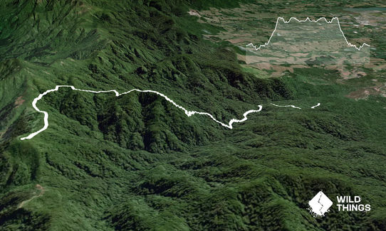
11.9km
950m
950m
588m


Last Updated: 6th Apr 2024
Submitted by Danielle Meier
Last Updated: 6th Apr 2024
Open
Grunt Factor: 29 ?
Gnarl Factor: 71 ?
11.9km
950m
950m
588m
Front country - easily accessible
Out and Back
Very hilly
With permit
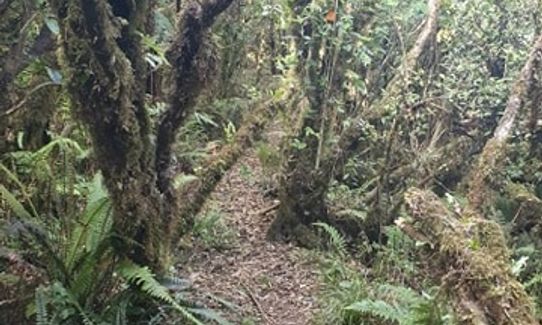
Native bush
Easy Single Track
Moderate Single Track
Technical Single Track
Average Uphill Gradient: +15.6%
Average Downhill Gradient: -15.6%
VIP Feature: Send this route to your Garmin account so you can follow the course on your Garmin device.
Login as a VIP to see the trailhead information.
3:20
Slow
2:40
Moderate
2:00
Fast
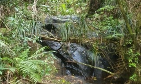
Once you start on the track its pretty easy to follow. 1km in there is a river crossing but this can normally be navigated without getting your feet wet.
The whole way through you will be following the orange DOC signs, All turns are marked with DOC trail signs so extremely hard to miss. The first one is marked as straight ahead to Thompsons track or right to get to Mount Eliza - you want to take the Mount Eliza track. Once you get to the Mount Eliza sign you can go straight to see the mine shaft which is a 5 minute detour.
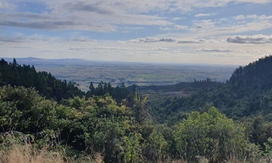
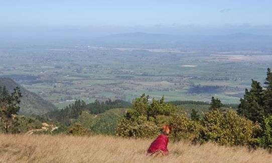
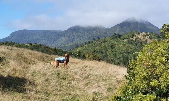
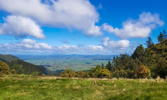
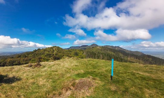
The head uphill / right following the signs to the North South track. Once you reach the North South track sign, you want to head left / south until you reach the summit. You will emerge at the top on the Kaimai ranges in a wonderful open field with epic views. You can explore up here for a bit but the best way back to the car is to back-track. You can make a loop by connecting to Thompsons track and following that back to the car park, but its extremely hard to do that without getting stuck up to your hips in mud pits!
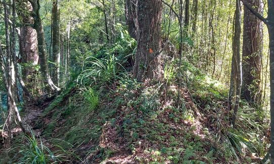
This track takes you past the Mount Eliza mine and as you go through you can see sign of old mining spots.
If you know of any public toilets near the trail start or on the route, please login and then let us know so we can update this section.
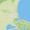
On the right hand side of the clearing by a large tree you will find the start of the track. There are obvious orange DOC signs and a few minutes down the track you will see the first DOC sign with track names and estimated times.
37 km
36 minutes
With Permit
No
Moderate.
Non-existent.
Waterproof leggings, Thermal leggings, Lightweight fleece top, Long-sleeved thermal top, Seam-sealed waterproof jacket, Windproof jacket, Gloves, Beanie/thermal headwear, Personal Locator Beacon (PLB), Whistle, First aid kit, Extra food for emergencies, Survival blanket, Cellphone, Map, Headtorch and spare batteries
There is a river crossing 1km in that I assume would be drinkable but have never tried.
Very muddy after rain. Slippery in winter. Can have very strong cold winds at the very top of the trail at the turn around point. If it's a very cloudy, overcast day you will get up into the clouds and it will get a lot colder/ damper than at the start of the trail.
Mud and slippery roots, flax on trail. Very technical trail.
Forta Leza
2656 State Highway 2
https://www.facebook.com/Forta-Leza-Restaurant-Official-175575129206702/
They do delicious Pizza's, Coffee and have a good range of beer! awesome spot to refuel afterwards
Trail Legend
Login as a VIP to become a Trail Legend. Learn about Trail Legends.
Fastest Known Times (FKTs)
You and Eliza Mine Climb
As a VIP member you can record private notes for this trail, see all of your times and more.
Already have an account? Login now
Gnarly trail that requires good sense of direction and done good legs for the climb up. We went off piste a couple of times and took a little time to find the trail again at one point in the north-south section. Views were amazing at the top.
We planned our adventure on the slowest time given but should have looked at the FKT as it took us the better part of 5 hours to complete. Still smiling tho.
January 18
ED
I was not really feeling this one - out and back, with steep climb and tired body. Still good to experience more of the Kaimai Range! Track conditions gets proceedingly worst as you travel out (mainly fern/grassy over growth), pretty well marked tho.
February 29, 2024
JM
It's a great venture out. A great climb and views from the summit. Only about 50% runnable. When wet, it's muddy & slippery so take care - especially on the return home as It is steep in parts. Thoroughly enjoyable.
October 25, 2021
Hard to run… or hardly runnable?!
Glad I scoped it out as a hike first - turned back about 800m before the summit as I’d run out of food and energy! I’ll be back though 😅
October 24, 2021
Send to your phone
Scan the below QR code to open this trail on your phone.

Tip: position the QR code in your phone camera screen.