Last Updated: 13th Jan 2025

Beginner - Intermediate

Save Trail Save

I've done it Done

Mangorewa Loop Track

Tauranga, Bay of Plenty

Submitted by Glen Brownlee

Last Updated: 13th Jan 2025

Beginner - Intermediate

Save Trail Save

I've done it Done

Open

Grunt Factor: 13 ?

Gnarl Factor: 60 ?

8.6km

205m

220m

515m


Login as a VIP to see driving directions, distance and time.

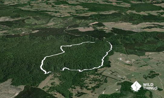
Trail Map

Type of Run

Front country - easily accessible

Loop

Undulating, small hills only

Native bush

Run Makeup

10%
30%
60%

Easy Single Track

Moderate Single Track

Technical Single Track

Average Uphill Gradient: +4.4%

Average Downhill Gradient: -4.7%

Trailhead

Login as a VIP to see the trailhead information.

Estimated Times to Run

2:30

Slow

2:00

Moderate

1:15

Fast

Do NOT attempt this if there has been any reasonable rain in days beforehand.

The track entrance is 500m north of the car park on the left. Carefully cross the road, walking north (against the traffic, on narrow berm) and cross the second bridge, 100 m up the hill, carefully cross the road again to find the track entrance immediately behind the sign for the Mangorewa Ecological area.

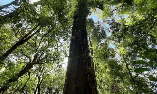
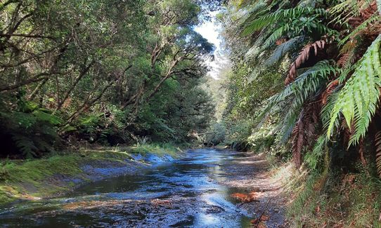
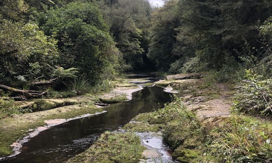
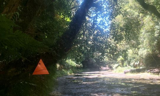
The first section up the Ohaupara stream is not well marked, if dry just head up creek bed, you will see markers on both banks from time to time. At about 1km mark there is fork in stream bed, head into left branch and you will see track head up bank on your right. Steep climb to ridge then great track through great old Podocarp forest- Beech, Rimu, Miro, Kahikatea & Kauri.

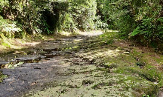
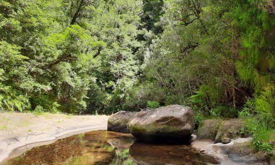
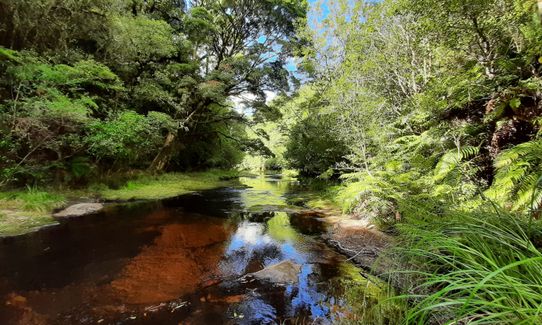
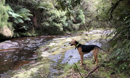
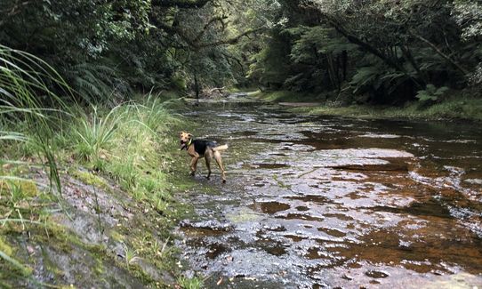
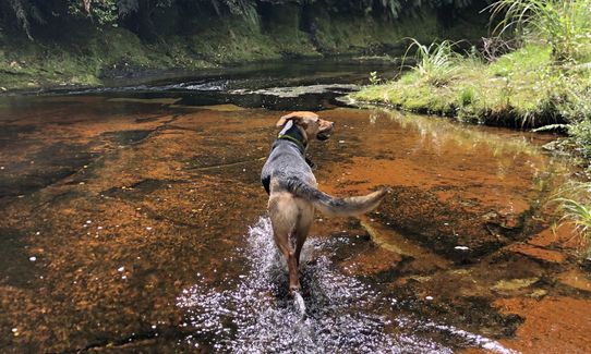
At about 2.5km mark there is another climb to next plateau, here the track gets more technical, roots, constantly zig zagging around trees & obstacles, but well-marked. You then start descending towards the Mangorewa Stream. The last third of the track is most likely something you have never done before. It's bedrock stream bed from 6-15m wide with gentle gradient (steep bush clad banks). The issue/challenge is most of it (even in driest season) is treacherously slippery, like ice. One minute you're making good time, then you’re on your arse, and it could hurt you. Take care, poles will help some, but even then, there’s nothing for them to dig into, so just slip across top bedrock. The other thing to look out for are deep pot holes in stream bed.

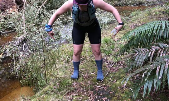
Leave the river bed via the right bank just before the road bridge. A small track exits the stream to the car park. Regardless of how dry it is you will have wet feet as there are section you will have to wade through. This CANNOT not be done after heavy weather as river bed will be a torrent of water. You will either enjoy the challenge of this trail, or hate it because it gets the better of you.
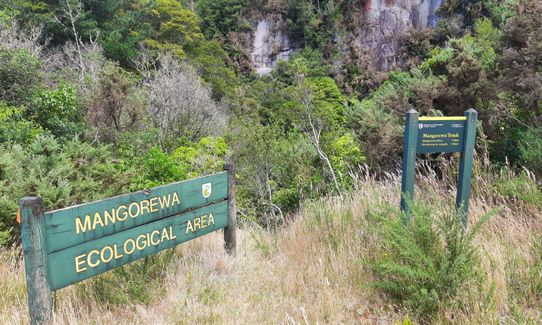
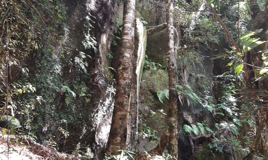
Being able to run down bedrock river bed cut through forest - awesome.

If you know of any public toilets near the trail start or on the route, please login and then let us know so we can update this section.

Carpark busy in the summer, but you will usually find a space. Note is is a dangererous piece of road, so be careful pulling off & out.

28 km

22 minutes

Unknown

No

Moderate.

Non-existent.

Long-sleeved thermal top, Seam-sealed waterproof jacket, Personal Locator Beacon (PLB), Whistle, First aid kit, Extra food for emergencies, Cellphone, Map

First stream may be running, but is right at start of run. The Mangorewe stream will have some water at most times of the year, but may need treating.

After heavey rain, or days of steady rain Mangorewe will be running fast and would not be safe choice, turn around & loop back out, missing stream/river bed section.

Trail Legend

ED

Emma Dryland

has completed Mangorewa Loop Track once in the last year.

Learn about Trail Legends.

You and Mangorewa Loop Track

As a VIP member you can record private notes for this trail, see all of your times and more.

Register Now

Already have an account? Login now

Trail Reviews

Thanks for the heads up on the over socks. I took two poles too and stuck to the thick green moss on the river sides. Nice to feel remote with out too much travel.

Emma Dryland

Monday at 7:47pm

I'd recommend doing this with another person as creek bed is super slippery even in places with no water. Came a gutser 3 times and was trying to be careful. Added to that a couple of times where hidden holes meant leg went up to knee with potential for injury makes this a track not to be taken too lightly. Other than that pretty good adventure. Hard to get any rhythm going but the creek bed in summer is a bit surreal and worth the effort for that alone.

Anthony Sowerby

January 2, 2022

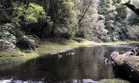
Definitely a socks over shoes kinda run! Slow going, ankle breaker territory for the first half and slippery and wet for the second half! But still a pretty ace wee loop with lots of natives to see and a good bit of bird life too!

Lauren Mai Anderson

October 17, 2021

We did this back in 2019, its an awesome run/walk but not for the faint hearted, we got lost in the first 200m of the trail!
If you like an adventure this is definitely worth a go, the last 4 km is on the river, it is hard bedrock that is like running on soap! I wish we had taken a lilo of tyre inner it was super fun, I think I fell over five times.
Can't wait to do it again!

Porscha Pearce

September 7, 2021

Login to submit a review

Trail Running Community

Find people who are interested in or have completed this trail run.

You must register or login to view this feature.

Register Now

Other trails nearby
Mauao - Round, Up and Down

Mauao - Round, Up and Down

Length: 6.0km

Level: Beginner

Eliza Mine Climb

Eliza Mine Climb

Length: 11.9km

Level: Beginner - Intermediate

Whakamarama Loop

Whakamarama Loop

Length: 21.1km

Level: Intermediate

Oropi Grove MTB Gliding

Oropi Grove MTB Gliding

Length: 8.0km

Level: Beginner

Find more trails and peaks nearby