Last Updated: 27th May 2024

Intermediate

Save Trail Save

I've done it Done

Beer Bum Bluffs

Christchurch, Canterbury

Submitted by Tony Sharpe

Last Updated: 27th May 2024

Intermediate

Save Trail Save

I've done it Done

Grunt Factor: 18 ?

Gnarl Factor: 58 ?

9.5km

530m

530m

410m


Login as a VIP to see driving directions, distance and time.

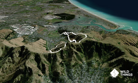
Trail Map

Type of Run

Urban fringe

Loop

Very hilly

Open farmlands

Open tussock/grasslands

Open ridges/tops

Volcanic

Run Makeup

10%
10%
40%
40%

Farm Road / 4WD Track

Easy Single Track

Moderate Single Track

Technical Single Track

Average Uphill Gradient: +14.0%

Average Downhill Gradient: -13.6%

Trailhead

Login as a VIP to see the trailhead information.

Estimated Times to Run

2:00

Slow

1:30

Moderate

1:00

Fast

Park up at the trail head. Note the sign about rockfalls, but don't worry as the trails are well maintained and looked after by an awesome group of local volunteers.

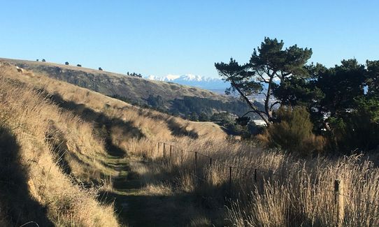
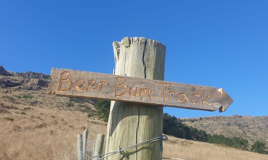
Head up the few sets of stairs and zig zags until you reach a junction. Don't keep going up here, this is where you come back down later - unless you are doing the loop in reverse. Take the right turn to into the old quarry. Pass a seat and a bunch of kids' swings and carry on sidling above the houses. After a while leap the over a stile and hum along a few switchbacks and gain some more height. This is great trail running and you'll pass the sign for the Beer Bum Track - follow this.

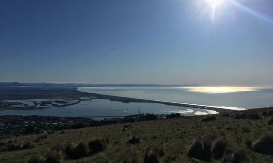
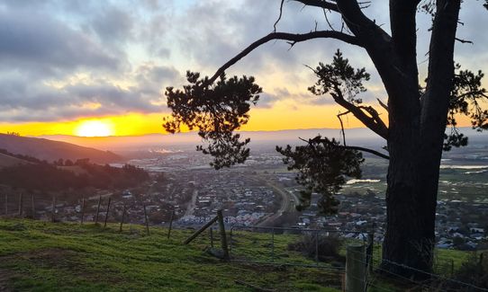
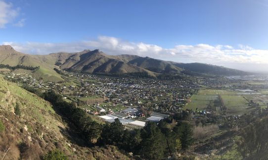
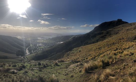
The trail does a wide swing around the side of the valley well above Heathcote. Lovely sweeping views out over Christchurch here. Keep trucking on what is now called Morgans Track all the way round, under the gondola and around to the Bridle Path. Head up the hill here via the infamous Pipeline Track and grovel all the way to the top of the hill on the old Summit Road.

At the top of Pipeline head along the old Summit Road, which is now forever closed to traffic. Look out for bikes while you enjoy the sweeping views. Carry on up the road until you cross a cattle stop by some rock climbing sites. Here you'll pick up the John Brittan shared use trail and follow this onto the Kenton Track, which drops you down to the houses at the top of Mt Pleasant.

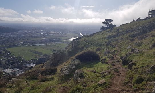
Keep going on the Kenton track as it traverses the top of the bluffs. Awesome technical trails here all the way to the top of the Heathcote Quarry Trail which you follow back down to the start, again noting but not worrying about the rockfall signage. The track is good, and well looked after. Take care on this steep often slippery descent - it's a good idea to have your grippiest footwear on for this section. Could be especially treacherous in the wet.
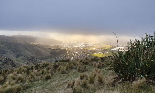
Old Heathcote quarry site; The infamous Pipeline; Christchurch Gondola; Superb views

Nearest public toilet to trailhead: at the Heathcote Domain, 1.2km along Bridle Path Road towards the Gondola.

The Lyttelton Bus gets you within a block or two if you don't have a car, or you could get off the bus and the Gondola base station and start the loop part way round

11 km

18 minutes

No

No

Moderate.

Don't drop into the houses on the side trails - other than that it's pretty intuitive.

Perfect throughout.

Long-sleeved thermal top, Seam-sealed waterproof jacket, Windproof jacket, Gloves, Beanie/thermal headwear, Whistle, First aid kit, Extra food for emergencies, Cellphone, Map

There's a tap at the foot of the bridle Path if you need it, small diversion down to reach it.

Muddy in sheltered shady parts in winter or when rain has been about.

Take care above the bluffs, and don't rush down the final descent

Heathcote Valley Inn
2 Flavel St, Heathcote
http://valleyinntavern.co.nz/
Great little pub

Christchurch Gondola Top Station
Top of Mt Cavendish
https://www.christchurchattractions.nz/christchurch_gondola/
Great views, food and beverages

Trail Legend

Brad  Rivers

Brad Rivers

has completed Beer Bum Bluffs twice in the last year.

Learn about Trail Legends.

You and Beer Bum Bluffs

As a VIP member you can record private notes for this trail, see all of your times and more.

Register Now

Already have an account? Login now

Trail Reviews

A Cracking mix of technical trial and out-and-out grunt. The road section at the top is almost a welcome relief and gives you time to try to get the legs back from a jelly like state. As mentioned there are boulders that have come down from above, but they are from the big shake and I don't think any are recent (someone may correct me). I think as with many of the Port Hills closures it is down to money, time and paperwork.

Brion Matthews

August 12, 2021

Ok, so, full marks for an inspired route with gorgeous views traversing several new trails for me! I had a great time running it. However, I cannot in good conscience recommend this to others, nor will I be repeating it. The council has marked many tracks in the Port Hills as “rockfall warning, proceed with caution” however it has marked portions of this as “closed due to rockfall risk”. The reason for this is obvious: just before you get to the Bridle Path there are a bunch of large boulders that have crashed into the protective fence. Proceed at your own risk.

Matt Halverson

July 8, 2021

Underestimate this sub 10km loop at your peril! We didn't get to the start until 4:30pm in mid July, and had only one headtorch between the two of us. Awesome sunset and views of course, with the pipeline grunt keeping us busy, but we quickly noticed the temperature drop at the summit as the light drained from the horizon. The easterly seemed to push the low clouds right through to the bones, and despite putting on the merino gloves, my hands never really recovered.
The descent through the wide open John Britten reserve was an adrenaline fuelled blast, but reality set upon us by the time we hit the bluffs near the Mt Pleasant houses. Dark, wet, slippery, and sobering drop-offs brought our pace down to a slow walk for the most part, with a cautious shuffle at best. Text messages from anxious love ones reminded us that we were well overdue..
In hindsight, all of this was entirely predictable, and with the right preparation, this trail is easily five stars! I look forward to returning on a warm summer day.

Scott Ferguson

July 5, 2021

This is a great trail, Heathcote locals have been keeping this gem to themselves but now the secret is out. The Beer Bums part of the track was created over lockdown and has been a great improvement on the original track, just remember not to go to hard at the start because the Pipeline is tough ( Tony you are a Monster ) once you get to the summit road, enjoy the view and let you heart and lungs recover before setting off on the rest of the trail. Be warned that over Winter this track can get slippery and muddy in places.
On completion of this trail be aware that there is a Coffee shop called Upshot at the Horse Riding School on Bridle path road after this epic trail you probably deserve a drink and a treat.

Callum Templeton

October 22, 2020

Login to submit a review

Trail Running Community

Find people who are interested in or have completed this trail run.

You must register or login to view this feature.

Register Now

Overlapping Trails

These overlap with this trail to some degree. You may wish to combine them but please note that to qualify for FKTs on these runs you should record a separate activity for each.

Gang of Four

Gang of Four

Length: 15.7km

Level: Beginner - Intermediate

Trinity - Harbour Bruisin'

Trinity - Harbour Bruisin'

Length: 20.1km

Level: Intermediate

Mary Had a Little Lamb

Mary Had a Little Lamb

Length: 7.3km

Level: Intermediate

Morgans Baa Baa Loop

Morgans Baa Baa Loop

Length: 5.2km

Level: Beginner

Boulder Dash

Boulder Dash

Length: 21.5km

Level: Intermediate - Experienced

Lyttelton Semi-Circle

Lyttelton Semi-Circle

Length: 5.7km

Level: Beginner - Intermediate

Mt Pleasant Trig

Mt Pleasant Trig

Length: 5.9km

Level: Beginner

Other trails nearby
Lava Lite

Lava Lite

Length: 6.7km

Level: Intermediate

Up Hill Down Valley

Up Hill Down Valley

Length: 10.8km

Level: Beginner - Intermediate

Horse Latitudes

Horse Latitudes

Length: 5.1km

Level: Beginner

Hagley Figure of 8

Hagley Figure of 8

Length: 10.0km

Level: Beginner

Find more trails and peaks nearby