Last Updated: 13th Mar 2024

Intermediate - Experienced

Save Trail Save

I've done it Done

Port Hills Nearly Half Marathon

Christchurch, Canterbury

Submitted by Tim

Last Updated: 13th Mar 2024

Intermediate - Experienced

Save Trail Save

I've done it Done

Notice More info

Grunt Factor: 18 ?

Gnarl Factor: 18 ?

18.0km

555m

555m

423m


Login as a VIP to see driving directions, distance and time.

Trail Map

Type of Run

Urban fringe

Loop

Very hilly

Dog Friendly

Native bush

Open farmlands

Open tussock/grasslands

Open ridges/tops

Volcanic

Run Makeup

30%
25%
25%
20%

Sealed Road

Farm Road / 4WD Track

Easy Single Track

Moderate Single Track

Average Uphill Gradient: +8.0%

Average Downhill Gradient: -8.1%

Trailhead

Login as a VIP to see the trailhead information.

Estimated Times to Run

3:00

Slow

2:15

Moderate

1:30

Fast

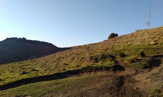
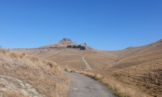
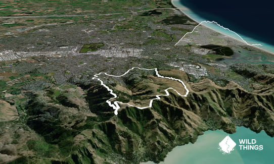
Starting at the bottom of Rapaki Rd, grind your way up Rapaki Rd and Rapaki Track until you reach the top of the Port Hills (under 30 mins for the Rapaki climb is a good target). Once you reach the top, head west along the Summit Rd or the nearby track. Keep a careful eye out on your right for the drop down onto the Harry Ell Walkway. Follow this down the hill until you reach Dyers Pass Rd. Follow Dyers Pass Rd (or Hackthorne Rd) all the way down until you reach Centaurus Rd. Turn right on Centaurus and stick on it until you back to your starting point.

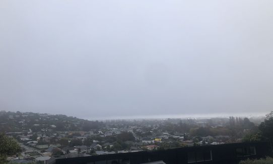
The Port Hills get their name because of the fact that they lie between Lyttelton Port and Christchurch City, so at the top of this run you get views down into Lyttelton Harbour. The harbour and the hills are apparently the result of a volcanic eruption so they are also interesting for the budding geologist.

If you know of any public toilets near the trail start or on the route, please login and then let us know so we can update this section.

You can park on Rapaki Drive but it's usually easier and safer to park on Centaurus Road.

5 km

11 minutes

Yes

No

Moderate.

You need to look carefully for a way off Dyers Pass Rd onto Harry Ell Walkway. Harry Ell Walkway comes out at a point on Summit Rd just before Sign of the Kiwi Cafe.

Perfect throughout.

Thermal leggings, Long-sleeved thermal top, Seam-sealed waterproof jacket, Beanie/thermal headwear, Whistle, First aid kit, Extra food for emergencies, Cellphone, Map, Headtorch and spare batteries

There is one water fountain on the Harry Ell Walkway. Do not collect water from the ponds along the way as it is unlikely to be safe to drink.

The Port Hills ridge line is often windy which can be freezing in winter and hot in summer.

Protocol
2 Colombo St
http://www.protocoloncolombo.co.nz/
These guys serve a good beer and often have live music.

Zeroes Cafe
81 Cashmere Rd
https://www.facebook.com/Zeroescafe/
Here you will find a superb coffee for your post-run energy boost. You're also likely to encounter lycra-clad cyclists - I'll leave it up to you to decide whether or not that's a reason to recommend...

Trail Legend

Gregory Bassam

Gregory Bassam

has completed Port Hills Nearly Half Marathon 3 times in the last year.

Learn about Trail Legends.

You and Port Hills Nearly Half Marathon

As a VIP member you can record private notes for this trail, see all of your times and more.

Register Now

Already have an account? Login now

Trail Reviews

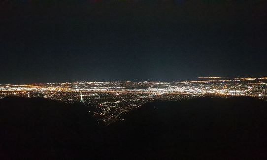
If you do the route as written it is basically a road run with a wee bit of trail. Even FKT hunting I can't bring myself to run along the summit road, not when there's the much more fun Crater Rim trail or Bowenvale traverse MTB track that both run parallel to the road. So the 4 stars are for variations on the original route.....One good thing about this route (and it's variations) is that it's a great option in the dark. Plenty of streetlights on the at least 6km of road running, and being up two major Port Hills trail motorways also you're very rarely alone on these trails even in the wee hours; there's always other runners/walkers. And you really can't get lost on this route..

Maggie Davies

July 25, 2020

I like Rapaki and I like Harry Ell, but turns out I dont like them both in the same run... too much road for my tastes!

Matt Halverson

June 27, 2020

If I followed the gpx on this route I would be rating this 2 stars as it is essentially Christchurch's two most known hillwalks connected by over 10km of road running...not very wildthings! However, if you take the shared path from the top of Rapaki all the way to Vic park and thru to Harry Ell, then via off towards Longhurst Tce and down the back roads and hidden trails that lead down to Hollis Ave, you can cut the road running in half. I would recommend starting at bottom of Hollis Ave to use the flat road running at start for a warm up and avoid traffic issues of parking near Rapaki.

Rebecca Sunderland

May 7, 2020

Back today for the mostly tarmac version. Nice to.switch off and cruise

Tony Sharpe

February 15, 2020

Login to submit a review

Trail Running Community

Find people who are interested in or have completed this trail run.

You must register or login to view this feature.

Register Now

Overlapping Trails

These overlap with this trail to some degree. You may wish to combine them but please note that to qualify for FKTs on these runs you should record a separate activity for each.

Rapaki Sugarloaf Return

Rapaki Sugarloaf Return

Length: 15.0km

Level: Beginner - Intermediate

Sign Of The Takahe - Rapaki

Sign Of The Takahe - Rapaki

Length: 13.0km

Level: Beginner - Intermediate

VKV challenge

VKV challenge

Length: 10.0km

Level: Intermediate

Gondola Gallop

Gondola Gallop

Length: 11.3km

Level: Beginner - Intermediate

Lava - H.ELL Loop

Lava - H.ELL Loop

Length: 10.3km

Level: Intermediate

Port Hills Spur Challenge!

Port Hills Spur Challenge!

Length: 18.5km

Level: Intermediate

Up Hill Down Valley

Up Hill Down Valley

Length: 10.8km

Level: Beginner - Intermediate

Vicki Vale

Vicki Vale

Length: 9.3km

Level: Intermediate

The North Faces

The North Faces

Length: 24.8km

Level: Beginner - Intermediate

Dry Run to Tamatea's Leap

Dry Run to Tamatea's Leap

Length: 10.0km

Level: Beginner - Intermediate

Montgomery Loop

Montgomery Loop

Length: 7.9km

Level: Beginner - Intermediate

Mt Vernon Farm Track

Mt Vernon Farm Track

Length: 7.4km

Level: Intermediate

Holliss Stairway to Heaven

Holliss Stairway to Heaven

Length: 8.7km

Level: Beginner - Intermediate

Pour Some Sugarloaf On Me

Pour Some Sugarloaf On Me

Length: 8.3km

Level: Beginner - Intermediate

Bowenvale / Huntsbury Loop

Bowenvale / Huntsbury Loop

Length: 11.2km

Level: Beginner - Intermediate

The Bowenvale Elevator

The Bowenvale Elevator

Length: 11.2km

Level: Beginner

Other trails nearby
The Chairlift Choice

The Chairlift Choice

Length: 5.7km

Level: Beginner

Bottle Lake Blue Loop

Bottle Lake Blue Loop

Length: 10.0km

Level: Beginner

A Diamond in the Rough

A Diamond in the Rough

Length: 19.0km

Level: Beginner - Intermediate

Lyttelton to Diamond Harbour

Lyttelton to Diamond Harbour

Length: 43.5km

Level: Intermediate

Find more trails and peaks nearby