Last Updated: 16th Feb 2024
Heaven's Gate
Submitted by Mike Steel
Last Updated: 16th Feb 2024
Open
Grunt Factor: 112 ?
Gnarl Factor: 104 ?
30.0km
3200m
3000m
2608m


Last Updated: 16th Feb 2024
Submitted by Mike Steel
Last Updated: 16th Feb 2024
Open
Grunt Factor: 112 ?
Gnarl Factor: 104 ?
30.0km
3200m
3000m
2608m
Back country - remote
Point to Point (one way)
Mountainous
Native bush
Riverside
Open tussock/grasslands
Open ridges/tops
Moderate Single Track
Technical Single Track
Untracked / Route only
Average Uphill Gradient: +21.3%
Average Downhill Gradient: -21.0%
VIP Feature: Send this route to your Garmin account so you can follow the course on your Garmin device.
Login as a VIP to see the trailhead information.
Not suitable
Slow
11:00
Moderate
8:00
Fast
A spectacular and wicked outing traversing the central Seaward Kaikoura range with 3200 metres of climbing over 30k, mostly untracked.
Starting near sea-level, the route goes from tracked river valley to streams, scrub and wild ridges, traversing Mt Uwerau (2213m) and on to the highest point on the range (Mt Manakau 2608m) then heads north along the very top of the main Seaward Kaikoura range over Surveyor Peak (2365m) and Pt 2318, before making a sweeping descent down ridges, eventually landing in the Jordan stream for the final jog to the road.
It’s a big day out. Drop a bike up the Puhi Puhi valley road the night before. Early next morning (e.g. pre-dawn) drive to the end of Parson’s road to access the Hapuku river (or to complete the sea-to-sky theme, bike from the beach and finish back at the beach!). Run up the Hapuku valley, with several crossings of the river (tricky if high) until you reach a narrow gorge. Here cross to the western side of the river and pick up a marked track that climbs through bush – since the Kaikoura earthquakes this track now goes much higher than it used to before drops down and eventually meets the Hapuku west branch. Markers lead you to the Hapuku hut.
From here, cross the river and follow the marked track up-valley, until you hit the second side-stream coming in from the right (off Mt Uwerau). Head up this stream and at some point high up gain the scrubby spur on your left (make sure you fill up with LOTs of water before leaving the steam). After a short grassy/spaniard section you arrive at a flat point on the spur with the impressive south face of Uwerau in clear view.
From here it’s a steady but fairly straightforward climb to the summit up on the obvious spur (some rock scrambling in places, and a 200 metre section of scree – poles could be good, or put bike gloves on, get on all fours and channel your inner animal). The spacious summit of Uwerau is a great spot to rest and soak in the panoramic views. From here, begin the ‘interesting’ traverse to Manakau, which starts with a steep descent, then involves negotiating a section of exposed rocky outcrops – take care on these, they take a while (your pace may slow to 1km per hour here!). Once off them continue up through ‘heaven’s gate’ to join the main Seaward Kaikoura range, then on up to the summit of Manakau, with great views.
From here, there’s nice running heading north (down the standard approach to Manakau), interrupted with short sections of rock scrambling, after which ridge is then very straightforward and runnable till you reach the climb that leads up to Surveyor Spur and Surveyor Peak. From there, continue north along the range above the ‘basins’ and Pt 2318 beyond which is a prominent wide flat area (the other high point Te Ao Whakere is north of here). Now follow the obvious ridges that meander eastward over points 2109, 1910, 1636 and continue descending this ridge finishing with a scree slide into the northern branch of the Jordan river (no trail). Follow this riverbed out to the road/bike.
This trail includes the peaks Uwerau, Manakau and Surveyor Peak.
Expansive views of the coast, the inland Kaikoura range, the Clarence river, and beyond. Interesting rock formations en route.
If you know of any public toilets near the trail start or on the route, please login and then let us know so we can update this section.
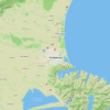
There is a public parking place by the Hupuku river (off Parson's road).
13 km
17 minutes
Unknown
No
Hard.
Note that most of this journey is completely untracked - that means no markers, no trail, and likely few (if any) cairns. You're on you own. Climbing Manakua via Uwerau is definitely not the easiest way to reach that summit.
A compass and map is essential - while the route is clear in good visibility, if cloud comes in it could be tricky and escape options are limited
(be prepared to turn back from Mt Uwerau summit, or descend down Surveyor spur which is the easiest route to/from Manakau if you have doubts en route).
Patchy.
Thermal leggings, Long-sleeved thermal top, Seam-sealed waterproof jacket, Gloves, Beanie/thermal headwear, Personal Locator Beacon (PLB), Whistle, First aid kit, Extra food for emergencies, Survival bag, Cellphone, Compass, Map, Headtorch and spare batteries, Gaiters
Plenty in the Hapuku and side stream and Jordan, but very limited water otherwise. A tributary of Stace Stream below the ridge near Surveyor Spur has water (requires a short descent off a saddle just before Surveyor Spur). Also, at the end of the rocky outcrops on the Uwerau-Manakau traverse we found water in a tiny stream on the nor-eastern side of the ridge. Snow patches can be useful, though by later summer these have disappeared and the range is very dry/barren.
As a 1-day `run' this is feasible in summer only, and in settled weather. Late summer the range can be very dry and barren.
This is a committing trip - so attempt it only in perfect settled summer weather, with good fitness and preparation. Take plenty of food, water and head-torch, warm clothes etc.
Don't attempt in a nor-wester (they can be very strong up there! - at least one climber has come to grief after been blown off the ridge).
Because much of this route is spent between 2000-2600 metres, it can be pretty cold.
There is a lot of loose fractured rock in the Kaikouras (not helped by the Kaikoura earthquakes). Moxie gaiters, and padded mountain bike gloves can be good and ensure you have sturdy trail running shoes/light boots.
If conditions change and you need to retreat, turn back from Uwerau, or once over Manakau head down Surveyor spur - don't be tempted by other 'shortcuts' (e.g. dropping straight into Stace Creek or off the 'Basins' into the Jordan Stream, which both become bluffed).
Fastest Known Times (FKTs)
You and Heaven's Gate
As a VIP member you can record private notes for this trail, see all of your times and more.
Already have an account? Login now
Sections of this route have been made harder/slower since the earthquake. It takes longer to get to Hapuku hut, the bottom part of Mt Uwerau (where the route leaves the stream) is more chossy, and Jordan stream has become quite a bit slower. Add at least a couple of hours or more to the overly-optimistic times above.
March 17, 2022
Send to your phone
Scan the below QR code to open this trail on your phone.

Tip: position the QR code in your phone camera screen.