Last Updated: 13th Jun 2024
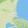
Woolshed, Bus Stop Loop
Woolshed Creek, Bus Stop
Miner's Track, Rhyolite Ridge Track, Mt Somers Track
Submitted by Sonja Vreugdenhil
Last Updated: 13th Jun 2024
Grunt Factor: 27 ?
Gnarl Factor: 72 ?
11.6km
840m
845m

Last Updated: 13th Jun 2024
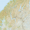
Miner's Track, Rhyolite Ridge Track, Mt Somers Track
Submitted by Sonja Vreugdenhil
Last Updated: 13th Jun 2024
Grunt Factor: 27 ?
Gnarl Factor: 72 ?
11.6km
840m
845m
Front country - easily accessible
Loop
Very hilly
Native bush
Open ridges/tops
Farm Road / 4WD Track
Technical Single Track
Average Uphill Gradient: +14.3%
Average Downhill Gradient: -14.5%
VIP Feature: Send this route to your Garmin account so you can follow the course on your Garmin device.
Login as a VIP to see the trailhead information.
4:00
Slow
2:00
Moderate
1:30
Fast
Start by taking the coal miners track to woolshed creek hut, this is a great warm up on relatively flat terrain.
About 2.5km in, the track branches and gives the option to take the 4wd track to the hut. Take this track and enjoy some climbing on wide trail. Once arrived at woolshed creek hut you will need to cross the creek. Follow the track 200m to the DOC sign which points left to Pinnacles Hut or straight/right to bus stop, Rhyolite Ridge and Woolshed Creek Carpark.
There will be some climbing to a swing bridge. Take the bridge over the gut and follow the track. The track is well marked from here, make sure you look up to see the markers as you climb. There will be a few steep descents and ascents to cross creeks either side of bus stop.
After bus stop there are some new board walks to keep your feet dry. The 8-9km in there is another DOC sign giving the option of Rhyolite Ridge or South Face. Take the track down Rhyolite Ridge. From here will be some technical descending to the carpark.
Mount Somers is prone to snow and permafrost. Many of the south facing slopes will be covered in ice during late autumn through to early spring. This will take longer than possible and may be dangerous. Respect the mountain at this time of the year and be prepared to take many parts slow.
Bus stop is a great place to stop for a snack. The early part of the track follows the old coal mining route.
Toilet present at the carpark.
Gravel road into the carpark plenty of parking with some cellphone reception.
13 km
25 minutes
No
No
Moderate.
The route is well marked by DOC. Always read the DOC signs at track junctions.
Very patchy.
Long-sleeved thermal top, Seam-sealed waterproof jacket, Gloves, Beanie/thermal headwear, Personal Locator Beacon (PLB), Whistle, First aid kit, Extra food for emergencies, Survival blanket, Cellphone, Map, Crampons / microspikes (for winter conditions)
Some streams available however these can be dry over summer.
Ice/snow over autumn, winter.
Streams can be dry in summer.
Can be very muddy in places following rain.
Although this is a well used track, take extra care over winter.
Staveley Store
Staveley
Great coffee and treats for after an adventure
Trail Legend
Login as a VIP to become a Trail Legend. Learn about Trail Legends.
Fastest Known Times (FKTs)
You and Woolshed, Bus Stop Loop
As a VIP member you can record private notes for this trail, see all of your times and more.
Already have an account? Login now
These overlap with this trail to some degree. You may wish to combine them but please note that to qualify for FKTs on these runs you should record a separate activity for each.
Send to your phone
Scan the below QR code to open this trail on your phone.

Tip: position the QR code in your phone camera screen.