Front country - easily accessible
Loop
Undulating, some big hills
Native bush
Open ridges/tops
Gravel Road
Easy Single Track
Moderate Single Track
Average Uphill Gradient: +21.8%
Average Downhill Gradient: -21.2%
Login as a VIP to see the trailhead information.
2:00
Slow
1:00
Moderate
0:35
Fast
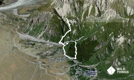
Start from the public shelter on Bowen Drive, in Aoraki/Mount Cook Village. Follow the DOC signs for Governor's loop track which takes you up through forest and down to the trail junction with Red Tarns track.
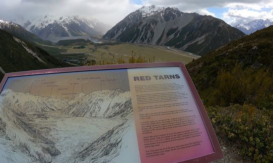
Take a right and cross the bridge to ascend to Red Tarns. At the top there is a short loop of the red Tarns lakes with some info signs.
Descend the way you came and continue straight at the junction with Governor's to take you back to the Shelter where you started.
Views of Aoraki/Mt Cook and the surrounding mountains. Enjoyable single track through forest.
If you know of any public toilets near the trail start or on the route, please login and then let us know so we can update this section.
Free parking at the shelter.
0 km
4 minutes
No
No
Easy.
Both are well marked DOC routes with signage. If in doubt, also present on map/devices.
Generally good.
Windproof jacket, Beanie/thermal headwear, Cellphone, Map
Water available at the start/end at the DOC shelter. Follow their advice on suitability for drinking.
Sir Edmund Hillary Alpine Centre
Mt Cook Village
Excellent cafe with reasonably priced food and good views :)
Fastest Known Times (FKTs)
You and Red Tarns & Governors
As a VIP member you can record private notes for this trail, see all of your times and more.
Already have an account? Login now
These overlap with this trail to some degree. You may wish to combine them but please note that to qualify for FKTs on these runs you should record a separate activity for each.