Last Updated: 10th Dec 2024

Intermediate - Experienced

Save Trail Save

I've done it Done

Kowai River Splash

Springfield, Canterbury

Submitted by Arjan Hulsman

Last Updated: 10th Dec 2024

Intermediate - Experienced

Save Trail Save

I've done it Done

Open

Grunt Factor: 17 ?

Gnarl Factor: 92 ?

10.5km

80m

80m

360m


Login as a VIP to see driving directions, distance and time.

Trail Map

Type of Run

Front country - easily accessible

Out and Back

Totally/mostly flat

Dog Friendly

Riverside

Run Makeup

100%

Untracked / Route only

Average Uphill Gradient: +2.1%

Average Downhill Gradient: -2.1%

Trailhead

Login as a VIP to see the trailhead information.

Estimated Times to Run

Not suitable

Slow

1:45

Moderate

1:15

Fast

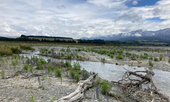
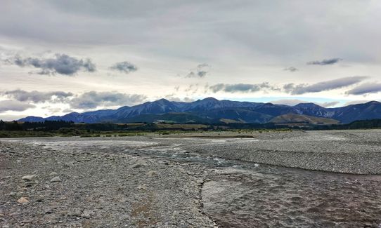
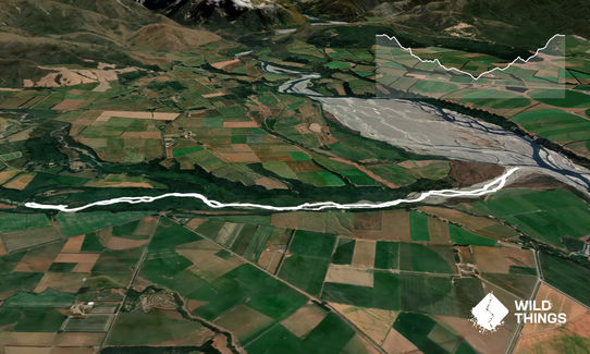
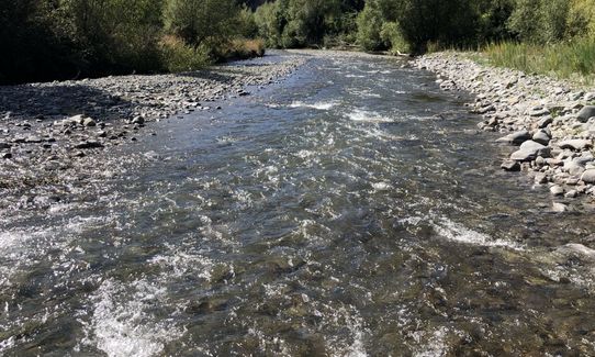
There are no track markers, but navigating this route will be fairly easy. You only can go one way. Just follow the Kowai river. From your start point you follow the river down stream over the many river banks and through many river crossings. There are heaps of little old stream beds you can follow to avoid a few river crossings. On some places you can choose to bush bash a bit to avoid the stream. The track ends at the Waimakariri River where you will have spectacular views over the Waimak and the Southern Alps. Back track your steps in return to your car or pick a different line up, in and around the Kowai river. Have fun!

If you know of any public toilets near the trail start or on the route, please login and then let us know so we can update this section.

Park down at the river. With wet weather it might be good to park just past the bridge if you have a 2wd car.

4 km

4 minutes

Yes

No

Easy.

Perfect throughout.

Personal Locator Beacon (PLB), Whistle, First aid kit, Extra food for emergencies, Cellphone, Map

Plenty water around, not sure about the quality, the rocks look a bit greasy. BYO.

Be careful after big rain. The river looks like it might flood once and while. In winter the water crossing can be pretty cold, so dress for cold water.

Sheffied pie shop
Sheffield
Prize winning pies

You and Kowai River Splash

As a VIP member you can record private notes for this trail, see all of your times and more.

Register Now

Already have an account? Login now

Trail Reviews

Really fun mini adventure for a hot day - did it in a nor'wester and had a blast! Gaiters recommended to keep the sand and shingle out, and I also found poles useful for stability on the crossings and shingle banks. Though there are countless crossings, none are difficult, and this would be good practice and a confidence builder for bigger riverbed routes such as Goat Pass.

Emily Oliver

January 21, 2023

Good trail, but its a once off for me, lots of river crossings and uneven running, rocks and shingle.

ewald kruger

January 5, 2021

What a great "trail", an easy adventure that I managed to squeeze in between two meetings. Nothing too challenging river wise, lost count of the number of crossings (30+ I guess). This was actually Plan B as the Benmore trail up the road a bit was closed due to Covid-19 but it was perfect.

Corey Woodward

May 8, 2020

This is a good trail if you want to do some river bed and river crossing training.

Ben Taylor

February 23, 2020

Login to submit a review

Trail Running Community

Find people who are interested in or have completed this trail run.

You must register or login to view this feature.

Register Now

Other trails nearby
Benmore Hut to the bushline

Benmore Hut to the bushline

Length: 14.5km

Level: Intermediate

Red Hill to Mt Lyndon Loop

Red Hill to Mt Lyndon Loop

Length: 16.6km

Level: Experienced

Rabbiting around Benmore

Rabbiting around Benmore

Length: 32.0km

Level: Intermediate - Experienced

Waimak River Run - Part 1

Waimak River Run - Part 1

Length: 20.0km

Level: Beginner

Find more trails and peaks nearby