Front country - easily accessible
Point to Point (one way)
Totally/mostly flat
Dog Friendly
Plantation/exotic forest
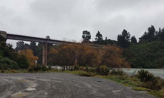
Riverside
Open farmlands
Easy Single Track
Average Uphill Gradient: +2.1%
Average Downhill Gradient: -1.8%
Login as a VIP to see the trailhead information.
3:00
Slow
2:15
Moderate
1:30
Fast
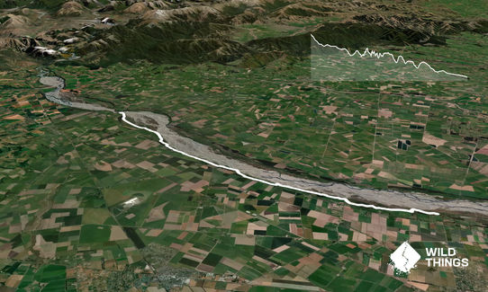
Part one of three runs, of approximately 20km, that will make up the Waimakariri River Run series (around 65km in total). Plenty of access points of Old West Coast and McLean's Island roads for support. Well maintained (graded) track that varies from rough gravel to flat sand with occasional water crossing (three at time of recording).
Follow the main graded path (obvious) the entire way. When presented with options do the following:
Bleakhouse Rd (10km) go left
Floodbank (13.1km) go left
Cooks Rd (16.2km) go right, then left
Ansons Rd (19km) go around bend to left
If you know of any public toilets near the trail start or on the route, please login and then let us know so we can update this section.
Car parking off SH72 or down the trail 100m or so there is a picnic area with plenty of space.
15 km
12 minutes
Yes
No
Easy.
Generally good.
Seam-sealed waterproof jacket, Beanie/thermal headwear, Whistle, First aid kit, Extra food for emergencies, Cellphone, Map
Plenty of water around but access/drink-ability is changeable. Carry at least 1 litre
After rain, water crossings may be deeper. Avoid after heavy rains if river is high as parts of this trail will be prone to flooding if the river bursts it's banks.
Water crossings would be less than knee deep normally, opportunities are present to rock/log hop to avoid getting wet feet but may be slippery.
Trail Legend
Fastest Known Times (FKTs)
You and Waimak River Run - Part 1
As a VIP member you can record private notes for this trail, see all of your times and more.
Already have an account? Login now