Last Updated: 21st Sep 2023
Gunn It!
Submitted by Mike Tennent
Last Updated: 21st Sep 2023
Grunt Factor: 8 ?
Gnarl Factor: 23 ?
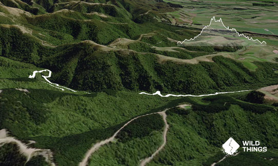
4.7km
200m
195m
371m
Last Updated: 21st Sep 2023
Submitted by Mike Tennent
Last Updated: 21st Sep 2023
Grunt Factor: 8 ?
Gnarl Factor: 23 ?
4.7km
200m
195m
371m
Front country - easily accessible
Combo
Undulating, small hills only
Native bush
Riverside
Easy Single Track
Moderate Single Track
Technical Single Track
Average Uphill Gradient: +7.9%
Average Downhill Gradient: -7.7%
VIP Feature: Send this route to your Garmin account so you can follow the course on your Garmin device.
Login as a VIP to see the trailhead information.
1:10
Slow
0:40
Moderate
0:30
Fast
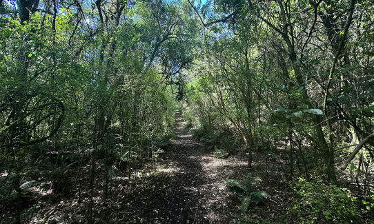
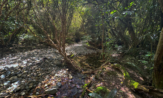
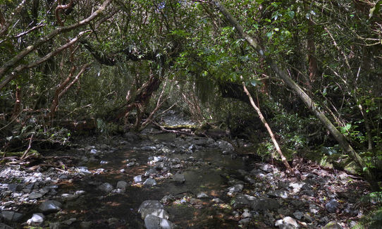
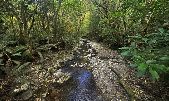
This is a very straightforward trail with no off-shoots. Follow the trail, gradually climbing along the stream for about 1.5km, at the trail split you can go left or right as the section loops back to here.
This is beautiful native bush running, often on a base of lovely moss.
Amazing moss ('carpet') on the early sections of the trail. many large Kotukutuku (tree Fuchsia), the largest Fuchsia in the world and one of very few native deciduous trees. Consequently there are bellbirds and stitchbirds around, although you will only hear them and rarely see them.
If you know of any public toilets near the trail start or on the route, please login and then let us know so we can update this section.
There is a reasonable size parking area.
12 km
12 minutes
Unknown
No
Easy.
Generally good.
Long-sleeved thermal top, Seam-sealed waterproof jacket, Personal Locator Beacon (PLB), Whistle, First aid kit, Extra food for emergencies, Survival bag, Cellphone, Map
Several streams and streamlets throughout the run.
Mud could be an issue in winter or after very heavy rain, also the stream could be an issue after heavy rain.
Slippery in places and a couple of short trail sections that require care.
Trail Legend
Login as a VIP to become a Trail Legend. Learn about Trail Legends.
Fastest Known Times (FKTs)
You and Gunn It!
As a VIP member you can record private notes for this trail, see all of your times and more.
Already have an account? Login now
These overlap with this trail to some degree. You may wish to combine them but please note that to qualify for FKTs on these runs you should record a separate activity for each.
Send to your phone
Scan the below QR code to open this trail on your phone.

Tip: position the QR code in your phone camera screen.