Last Updated: 21st Sep 2023

Beginner - Intermediate

Save Trail Save

I've done it Done

Rockin' the Mill

Napier, Hawkes Bay

Submitted by Melissa Franklin

Last Updated: 21st Sep 2023

Beginner - Intermediate

Save Trail Save

I've done it Done

Notice More info

Grunt Factor: 26 ?

Gnarl Factor: 18 ?

22.0km

760m

760m

233m


Login as a VIP to see driving directions, distance and time.

Trail Map

Type of Run

Urban fringe

Combo

Undulating, some big hills

Plantation/exotic forest

Run Makeup

15%
70%
15%

Gravel Road

Easy Single Track

Moderate Single Track

Average Uphill Gradient: +6.3%

Average Downhill Gradient: -5.9%

Garmin Course

VIP Feature: Send this route to your Garmin account so you can follow the course on your Garmin device.

Send to Garmin

Learn about sending to Garmin.

Trailhead

Login as a VIP to see the trailhead information.

Estimated Times to Run

3:00

Slow

2:30

Moderate

2:00

Fast

This run is through a mountain bike park and therefore requires a permit. You can buy a vistor permit from the Four Square in Bayview (on the way to the park) or any bike shop in Napier for $10. This gives you unlimited access for 3 weeks. Also be aware that you probably shouldn't run with headphones due to needing to be alert to watch/hear for mountain bikers.

For this route, from the carpark head up to the park taking the walking route up the hill rather than the mountain bike tracks. This walking route will lead to you to the top of the hill to a closed gate which you will need to climb over. Once over the gate go right (this is loop road) until you find Boar's Nest on your left. Run down Boar's Nest and follow the following tracks to complete the 22km circuit back to your car:
Boar's Nest
Left on to Dragonfly
Straight across Tinker Road to Lorax
Exit Lorax on to Valley Road, turn left
Exit Valley road to Shag’s Landing on left
Exit Shag's Landing right on to Loop road
Follow loop Road until just past where Valley Road joins it to get to Escalator (on right)
Exit Escalator back on to Loop Road and then go straight across to Skyline
Skyline turns into Mill Valley Road which eventually reachs the highest point and then heads down into the replanted block via South Mill Valley Road
Once you stop descending go up Blowhole on your left
Exit Blowhole on to Loop road
Loop road back to Shag’s Landing
Valley Road back to Lorax
Lorax to Loop Road back to TOP of Boar's Nest
Boar's Nest again
Return to top via Loop road
Climb gate and return to carpark
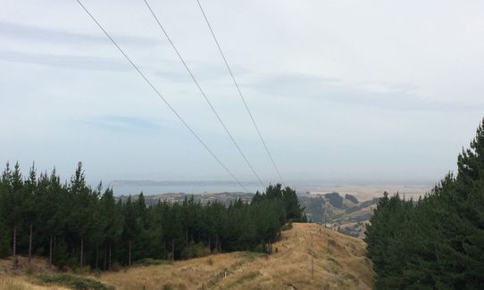
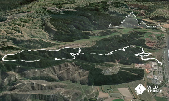
Views down the coast of Napier and out to sea

If you know of any public toilets near the trail start or on the route, please login and then let us know so we can update this section.

Carpark off the road

17 km

19 minutes

Unknown

No

Easy.

Get a map from a bike shop is you are worried about getting lost

Perfect throughout.

Seam-sealed waterproof jacket, Whistle, First aid kit, Extra food for emergencies, Cellphone, Map

None

wet and muddy in winter

Other users

You and Rockin' the Mill

As a VIP member you can record private notes for this trail, see all of your times and more.

Register Now

Already have an account? Login now

Trail Reviews

23/02/23 - the mountain bike park appears to be very closed (possibly still from the flooding). It is coned off with no public parking. I'd recommend further research before trying to run this one. It's not a 'turn up on the day' run as I tried to do!

Matt Johnson

September 23, 2023

Login to submit a review

Trail Running Community

Find people who are interested in or have completed this trail run.

You must register or login to view this feature.

Register Now

Other trails nearby
Tutira trig

Tutira trig

Length: 8.6km

Level: Beginner - Intermediate

Once Was An Island

Once Was An Island

Length: 8.4km

Level: Beginner

Kaweka Run and Soak

Kaweka Run and Soak

Length: 22.8km

Level: Beginner - Intermediate

Tangoio Tumbler

Tangoio Tumbler

Length: 9.7km

Level: Beginner

Find more trails and peaks nearby