Last Updated: 7th Jul 2024

Beginner

Save Trail Save

I've done it Done

To the Puketapu Pub!

Napier, Hawkes Bay

Submitted by Adrian Rhodes

Last Updated: 7th Jul 2024

Beginner

Save Trail Save

I've done it Done

Closed More info

The road bridge is washed out at Puketapu.

Please notify us if this has changed.

Grunt Factor: 14 ?

Gnarl Factor: 11 ?

16.3km

200m

210m

50m


Login as a VIP to see driving directions, distance and time.

Trail Map

Type of Run

Urban fringe

Loop

Totally/mostly flat

Dog Friendly

Native bush

Riverside

Run Makeup

10%
90%

Sealed Road

Easy Single Track

Average Uphill Gradient: +2.4%

Average Downhill Gradient: -2.5%

Garmin Course

VIP Feature: Send this route to your Garmin account so you can follow the course on your Garmin device.

Send to Garmin

Learn about sending to Garmin.

Trailhead

Login as a VIP to see the trailhead information.

Estimated Times to Run

2.15:00

Slow

1.50:00

Moderate

1.30

Fast

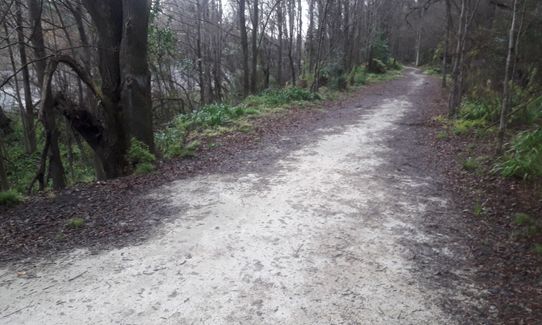
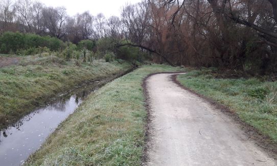
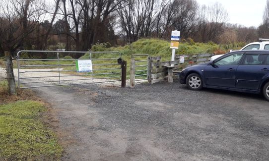
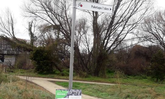
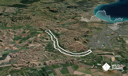
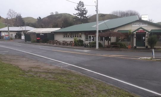
Park near the start of the track, look for the trail signpost directing you to Puketapu. Follow the limestone trail that leads you up this side of the river towards the half way point, Puketapu village. The trail comes out onto Puketapu Road, turn left and cross the road to continue for 500 meters on the limestone trail before turning left onto Dartmoor and towards Puketapu Village. Here, there is the Puketapu pub and a store should you wish to stop for refreshments.

Follow along Dartmoor Road, turning left at Vicarage Road towards the river, cross over the one lane bridge (be aware of cars). Turn sharply after the bridge and follow the limestone track back down the other side of the river.

Cross the river for the second time near Waiohiki Marae onto Redclyffe bridge. Using the cycle/walking way clip-on, run under the bridge and return to the carpark to finish the loop.

The Tutaikuri River. The Puketapu Pub and store at the half way point.

Te Mata peak and the Ruahine Ranges in the background.

If you know of any public toilets near the trail start or on the route, please login and then let us know so we can update this section.

There is plenty of parking on the side of the road by the track entrance. If this is full, park across the road at Otatara Pā Historic Reserve carpark.

6 km

8 minutes

Yes

No

Easy.

Perfect throughout.

Cellphone

None.

River may be high after heavy rain.

Cyclists on the track.
Cars crossing the road bridges.
Stock roaming on the track.

Puketapu Pub
679 Puketapu Road, Puketapu
https://thepuketapu.co.nz/
Great Country Pub

You and To the Puketapu Pub!

As a VIP member you can record private notes for this trail, see all of your times and more.

Register Now

Already have an account? Login now

Trail Reviews

Be the first to submit a review for To the Puketapu Pub!!

Login to submit a review

Trail Running Community

Find people who are interested in or have completed this trail run.

You must register or login to view this feature.

Register Now

Other trails nearby
Ōtātara Pā Historic Reserve

Ōtātara Pā Historic Reserve

Length: 3.5km

Level: Beginner

Tangoio Tumbler

Tangoio Tumbler

Length: 9.7km

Level: Beginner

Tutira trig

Tutira trig

Length: 8.6km

Level: Beginner - Intermediate

Once Was An Island

Once Was An Island

Length: 8.4km

Level: Beginner

Find more trails and peaks nearby