Urban fringe
Out and Back
Undulating, small hills only
Dog Friendly
Riverside
Sealed Road
Farm Road / 4WD Track
Easy Single Track
Moderate Single Track
Technical Single Track
Average Uphill Gradient: +3.6%
Average Downhill Gradient: -3.6%
Login as a VIP to see the trailhead information.
3:00
Slow
2:15
Moderate
1:45
Fast
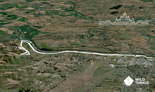
From the carpark go up the stopbank to limestone track. Go left and follow this track under the bridge. Head towards the river around one of the bridge supports (like you are going to go right to the water) and you should see the single track going to your left. Follow this track which will take you about 600m before exiting by a stream running into the river.
Go left here and go around the gate and then go right following the 4WD track that heads towards the river again. Follow this under the railway bridge and again it will take you around another stream, this time you will need to head up the stop bank and follow this for about 50m until your see a single track going down to the trees on your right.
Follow this track and the trail from that point should continue along the side of the river until about the 4km mark. However, you will need to keep your eyes peeled to where the track goes as sometimes you will follow a 4WD track to almost right to the river edge before you see the trail continuing. At the end of 4km you will meet another stream, go left here away from the river and after several steps you will see a low point of the stream which you can cross (yes you will get wet feet).
Continue following the trail long the stop bank. You can stay on this path right to its end or go to your right when a 4WD track goes down towards the river and pick your way through the grass area following any tracks left by 4WDs (this way is a little more tricky, but generally not too difficult and if you continue with keeping the stop bank to your left and river to your right you will eventually get to the end).
Once exiting the stop bank on to state highway 2, look across the highway to see a gate and old road that use to be the old state highway. Carefully cross the road and jump the fence and continue following this road as it heads up a hill and down the other side. After about almost 2km on this road you should arrive at the "remembrance pathways", these are a collection of pathways that go up Pukeora Hill. You want to enter the pathways through the gate and take the path that goes straight up. You will follow this pathway, always going straight if you meet other pathways. If you do this you will climb up Pukeora Hill and exit on the road. From this point I turn right and continue to the highest point via the road. Enjoy the views from the top and turn around and go back the way you came. If you are feeling a little tired, just run the stop bank all the way back to your car or adventure again on to the tracks alongside the river.
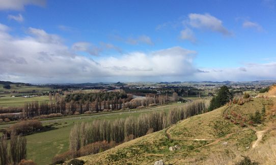
Nice views of Central Hawkes Bay
If you know of any public toilets near the trail start or on the route, please login and then let us know so we can update this section.
Generally safe as many people come and go
1 km
1 minutes
Yes
No
Moderate.
Just keep going, eventually you will either exit on a road or at the river. If you get really lost, find the stop bank and you will be fine.
Perfect throughout.
Windproof jacket, Cellphone
None other than the river, which I never drink from.
Wet, cold, muddy in winter. The stream crossing will be higher after periods of rain, but its not unsafe.
Watch for motorcyclists, mountain bikers and even the odd horse rider on these trails. Careful crossing the highway (100km zone).
Fastest Known Times (FKTs)
You and Wet Feet Stomp
As a VIP member you can record private notes for this trail, see all of your times and more.
Already have an account? Login now
BP
These overlap with this trail to some degree. You may wish to combine them but please note that to qualify for FKTs on these runs you should record a separate activity for each.