Last Updated: 4th May 2025
Quail Stream Loop
Last Updated: 4th May 2025
Open
Grunt Factor: 7 ?
Gnarl Factor: 13 ?
6.1km
155m
155m


Last Updated: 4th May 2025
Last Updated: 4th May 2025
Open
Grunt Factor: 7 ?
Gnarl Factor: 13 ?
6.1km
155m
155m
Urban fringe
Loop
Undulating, small hills only
Plantation/exotic forest
Open farmlands
Farm Road / 4WD Track
Easy Single Track
Average Uphill Gradient: +5.00%
Average Downhill Gradient: -5.10%
VIP Feature: Send this route to your Garmin account so you can follow the course on your Garmin device.
Become a VIP Member to see the trailhead information.
1:00
Slow
0:40
Moderate
0:30
Fast
If you have a 30-40 minute window in Blenheim and are looking for a short run with great scenery, the this one is for you - A nice short loop of the Wither Hills with enough elevation to warm up the legs and gentle downhill to get a decent pace.
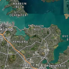
Starting at the Rifle Range carpark in the Wither Hills farm park, follow the signs for the Gentle Annie lookout/two tanks track. Once you get to the top at the Witches hat, go through the gate and continue the trail heading towards the Two Tanks in the distance.
At the two tanks, head to the left to head back down. The track straight ahead takes you further up and onto the Vernon Grand Traverse.
Wind your way down the trail taking in the sites above Blenheim and back across to the Richmond Ranges.
The trail then meets up at the top of the Quail Stream track. Follow the Quail stream back down. There are 3 creek crossings which are mostly dry but you can get wet feet if there has been decent rain.
Once at the bottom of Quail Stream head left along the Rifle Range track back to the carpark.
Toilets at the Carpark, another half way at the top of the Quail stream track and another at the Quail stream carpark.
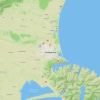
Park at Rifle range Carpark. Going down Taylor pass road from town, turn left at the rounabout onto Rifle Range road then a quick right into the carpark.
4 km
8 minutes
No
No
Easy.
Perfect throughout.
Windproof jacket, Whistle, First aid kit, Cellphone, Map
Water fountains at the carpark, Top of the Witches Hat and at the top of the Quail Stream track.
Farm animals.
Do you have a suggestion on where to go afterwards for the best coffee / cake / breakfast / brunch / beer?
Trail Legend
Login as a VIP to become a Trail Legend. Learn about Trail Legends.
Fastest Known Times (FKTs)
You and Quail Stream Loop
As a VIP member you can record private notes for this trail, see all of your times and more.
Already have an account? Login now
Send to your phone
Scan the below QR code to open this trail on your phone.

Tip: position the QR code in your phone camera screen.