Last Updated: 9th Jan 2025
Te Ara Tuhuno Taster
Link Pathway
Submitted by Rebecca Sunderland
Last Updated: 9th Jan 2025
Open
Grunt Factor: 13 ?
Gnarl Factor: 17 ?
10.9km
310m
320m


Last Updated: 9th Jan 2025
Submitted by Rebecca Sunderland
Last Updated: 9th Jan 2025
Open
Grunt Factor: 13 ?
Gnarl Factor: 17 ?
10.9km
310m
320m
Urban fringe
Out and Back
Undulating, small hills only
Dog Friendly
Native bush
Coastal
Easy Single Track
Moderate Single Track
Average Uphill Gradient: +5.6%
Average Downhill Gradient: -5.7%
VIP Feature: Send this route to your Garmin account so you can follow the course on your Garmin device.
Login as a VIP to see the trailhead information.
1:45
Slow
1:20
Moderate
1
Fast
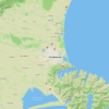
The Link Pathway / Te Ara Tuhono starts at the end of Dublin Street. The pathway gently sidles around on the seaward side of Queen Charlotte Drive, offering scenic views of Picton Harbour, Picton itself, Kaipupu Point Wildlife Sanctuary, and the Shakespeare Bay log-yard.
Follow the path beside the road, past the lookout over the working Port, until it transitions to the old stock route. This route was historically used to lead stock to the old Picton Freezing Works, which was once located near today's log yard.
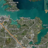
At about the 1.5km mark, the trail leaves the road edge and descends down to the edge of the estuary, where it follows a boardwalk and skirts the beach, home to various bird species. It then meanders through an impressive grove of tall podocarp trees, remnants of the forest that once covered the flats at the head of Shakespeare Bay.
Opposite the Shakespeare Bay Wharf a short side track on the inland side leads up to a lookout site and seat, offering a great view of any berthed log or cruise ships.
As you proceed, you'll encounter fun fairy doors at the base of large trees, near a lookout and seating area that offers views through the bush to Mabel Island and Kaipupu Point.
The pathway continues gently through mature beech trees, with two narrow sections due to storm damage but otherwise wide and well-graded. Not long after the Pathway turns west, a side track leads for 300 metres to the remains of a World War Two Lookout and Signal Station. Enjoy the view and come back the way you came!
If you have limited time, you can start at the 1.5km mark where there is a carpark, and follow the signs down to the estuary.
WW2 Lookout and Signal Station Historic Bridle Path.
If you know of any public toilets near the trail start or on the route, please login and then let us know so we can update this section.
Easy walking distance from the town centre or ferry terminal.
1 km
2 minutes
Yes
No
Trail Legend
Login as a VIP to become a Trail Legend. Learn about Trail Legends.
Fastest Known Times (FKTs)
You and Te Ara Tuhuno Taster
As a VIP member you can record private notes for this trail, see all of your times and more.
Already have an account? Login now
These overlap with this trail to some degree. You may wish to combine them but please note that to qualify for FKTs on these runs you should record a separate activity for each.
Send to your phone
Scan the below QR code to open this trail on your phone.

Tip: position the QR code in your phone camera screen.