Front country - easily accessible
Point to Point (one way)
Undulating, small hills only
Dog Friendly
Native bush
Riverside
Open farmlands
Open tussock/grasslands
Easy Single Track
Average Uphill Gradient: +1.2%
Average Downhill Gradient: -0.9%
Login as a VIP to see the trailhead information.
24:00
Slow
18:00
Moderate
15:00
Fast
It's a big day. Obviously, this can be run in either direction and both have equal merit. However, it is probably worth checking the weather forecast for wind as the Nor'wester can really get strong and may make an east-west run rather troublesome.
As a supported run, there are plenty of places for crew to come and visit, refuel, refresh and push you back out on track. The longest section with out access is about 13-15km. Unsupported is possible also with many small towns along the way, however, in summer be prepared to support local businesses and pay for water refills as it's a desert out there and water doesn't come easy.
In the 'off' season (winter) many of the small towns effectively close down, so it's worth phoning ahead if you are wanting to rely on shops or cafes etc.
The surface is pretty uniform, not much variety, it's well packed gravel the whole way. You don't need your deep tread mud shoes here, but a little cushioning goes well. The hills are gradual, both up and down, so much so that they pretty much feel flat... until late in the day! There are long flat and straight sections, remember it was a train alignment. However, there is generally always something new to look at, there are definitive milestones (literal and figurative) which come and go keeping things interesting.
It's worth noting that the milestones placed at kilometre intervals don't start from Middlemarch, they start some 62km further downstream, so don't be surprised if they don't match your 'kms to go'!
Spring and Autumn are probably best, with summer being brutally hot and dry and winter having a panache for frost fogs that last for weeks and don't let the temperature get above -3 degrees. There are definitely options to do it over a couple of days, but it's clearly possible in one push.
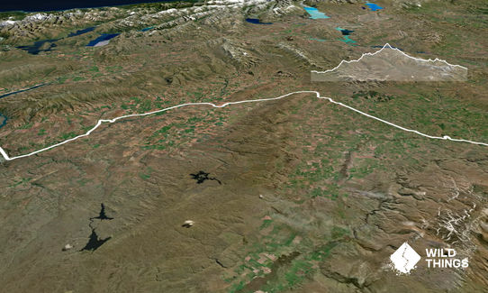
There's plenty of history along the way and loads of towns too. Tunnels, bridges, viaducts, bunnies, creeks, rivers, lots of schist cliffs and plenty of big sky central Otago.
If you know of any public toilets near the trail start or on the route, please login and then let us know so we can update this section.
There's a reasonable parking area at the Clyde terminus. Or it's about a 2km warm up from Clyde town centre.
26 km
20 minutes
Yes
No
Easy.
It's all pretty clear out there, there's plenty of signs where you cross the occasional road.
If it's late and you're getting tired, keep your eyes open and your wits about you when crossing roads, some are state highways and those cars are shifting along at 100km/hr!
Generally good.
Short-sleeved thermal top, Seam-sealed waterproof jacket, Gloves, Whistle, First aid kit, Extra food for emergencies, Survival blanket, Cellphone, Map, Headtorch and spare batteries
As noted above, water is available in the towns, however during the busy months the local businesses are over-run by trail users wanting to top up their bottles. As water can be scarce in Central Otago, some places will charge a small sum for a top up. If you are being supported by a crew in a car, bring a tank of your own.
There isn't much of any of the following: Shade, shelter, shade, shelter, shade or shelter.
The wind will find you, the sun will find you and in winter, if the frost fog is there... the cold will find you!
Be well prepared for changing weather. The winds can get really strong and there is nowhere to hide.
Strath Taieri Hotel - the only pub in Middlemarch
Opposite the Middlemarch Station
it's the only pub!
Fastest Known Times (FKTs)
You and Lost The Tracks - Otago Central Rail Trail
As a VIP member you can record private notes for this trail, see all of your times and more.
Already have an account? Login now