Last Updated: 21st Sep 2023

Beginner - Intermediate

Save Trail Save

I've done it Done

Potters Creek Loop

Cromwell, Otago

Submitted by Kieran Philip

Last Updated: 21st Sep 2023

Beginner - Intermediate

Save Trail Save

I've done it Done

Grunt Factor: 33 ?

Gnarl Factor: 10 ?

27.1km

1230m

1230m

1269m


Login as a VIP to see driving directions, distance and time.

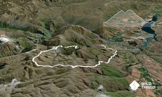
Trail Map

Type of Run

Front country - easily accessible

Loop

Mountainous

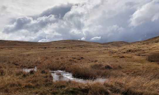
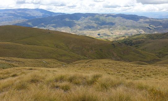
Open tussock/grasslands

Open ridges/tops

Run Makeup

5%
95%

Gravel Road

Farm Road / 4WD Track

Average Uphill Gradient: +10.0%

Average Downhill Gradient: -9.6%

Trailhead

Login as a VIP to see the trailhead information.

Estimated Times to Run

5:00

Slow

4:00

Moderate

3:00

Fast

Starting at the carpark on Pipeclay Gully Road, head back up the road you just drove down and take a right hand turn. About 50m onwards lake a left in through the Tennacreif Wines gate (public right of way) and follow the gravel road through which then turns on to a wee access track that passes through a few gates.

After the second gate, hop over the little stream and then take a left up the road up the hill. At the top of this small rise you'll see the Carricktown track carpark. Follow the Carricktown track uphill for the next 7.5km up past the Young Australian Water Wheel (you'll pass it on your left). You're on the look out for a DOC sign on your right which points you towards the Potters Creek reserve.

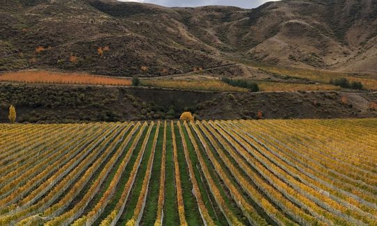
Jump on this 4WD track and follow it down in to Potters Creek. There is then a small climb back out up on to the tops again, where you keep following the main 4WD track down to Slapjack Saddle. Once at Slapjack, keep heading down in to Long Gully and follow the road out. Before you reach the vineyard, go through the gate on your right, follow the water race for a bit and then head up the hill on the road to the Long Gully track. This track will then take you back to Stewart Town and then you are over the stile to the right of Stewart Town and back down to your vehicle.
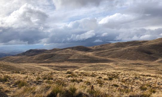
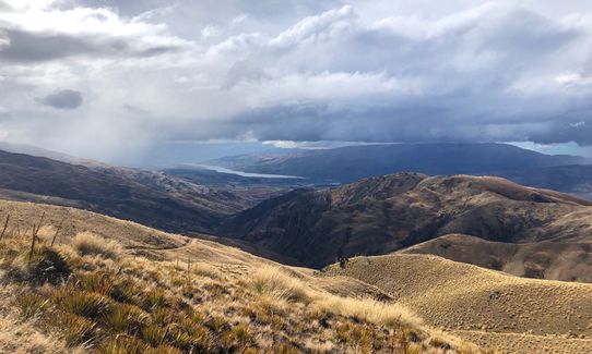
Old gold mining relics on the way up (Carricktown, Young Australian Water Wheel), lots of classic Central Otago views.

If you know of any public toilets near the trail start or on the route, please login and then let us know so we can update this section.

Quiet wee parking lot. Hardly ever many cars in there and pretty safe.

9 km

11 minutes

Unknown

No

Easy.

Generally good.

Long-sleeved thermal top, Seam-sealed waterproof jacket, Gloves, Beanie/thermal headwear, Whistle, First aid kit, Extra food for emergencies, Survival bag, Cellphone, Map, Headtorch and spare batteries

Water race on the way up the Carrick Range is fine to drink from, Potters Creek as well.

Very unpleasant in poor weather. Can be bitterly cold in the wind, as there is no cover.

Black Rabbit Cafe
Bannockburn
http://blackrabbit.nz/
Support the locals. :)

You and Potters Creek Loop

As a VIP member you can record private notes for this trail, see all of your times and more.

Register Now

Already have an account? Login now

Trail Reviews

Did this run with Andy Smith.Started at Lowburn so total run was 55km. Really enjoyed the loop and weather was ok. Could have been a lot hotter or a lot colder so we got a good day.
Lost our way a bit towards the end when needing to head away from the water race.
A good loop that I'd do again.

Mark Rigby

December 29, 2021

Login to submit a review

Trail Running Community

Find people who are interested in or have completed this trail run.

You must register or login to view this feature.

Register Now

Overlapping Trails

These overlap with this trail to some degree. You may wish to combine them but please note that to qualify for FKTs on these runs you should record a separate activity for each.

Young Australian

Young Australian

Length: 14.8km

Level: Beginner - Intermediate

Upper Pipeclay Track

Upper Pipeclay Track

Length: 23.0km

Level: Intermediate

Other trails nearby
Grandview Ridge Track

Grandview Ridge Track

Length: 38.0km

Level: Intermediate

Mt Pisa via Tinwald Burn Ridge

Mt Pisa via Tinwald Burn Ridge

Length: 25.0km

Level: Intermediate

Cairnmuir Hill

Cairnmuir Hill

Length: 26.7km

Level: Intermediate

Welshtown via Koinga, Kanuka and Logantown

Welshtown via Koinga, Kanuka and Logantown

Length: 11.0km

Level: Intermediate

Find more trails and peaks nearby