Last Updated: 21st Sep 2023

Intermediate

Save Trail Save

I've done it Done

Upper Pipeclay Track

Cromwell, Otago

Submitted by Kieran Philip

Last Updated: 21st Sep 2023

Intermediate

Save Trail Save

I've done it Done

Open

Grunt Factor: 36 ?

Gnarl Factor: 27 ?

23.0km

1310m

1310m

1236m


Login as a VIP to see driving directions, distance and time.

Trail Map

Type of Run

Front country - easily accessible

Loop

Mountainous

Open farmlands

Open tussock/grasslands

Open ridges/tops

Run Makeup

50%
25%
15%
10%

Farm Road / 4WD Track

Easy Single Track

Moderate Single Track

Untracked / Route only

Average Uphill Gradient: +10.2%

Average Downhill Gradient: -11.3%

Trailhead

Login as a VIP to see the trailhead information.

Estimated Times to Run

4:30

Slow

3:30

Moderate

2:30

Fast

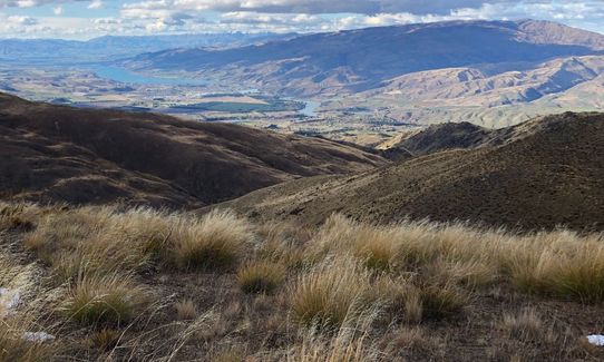
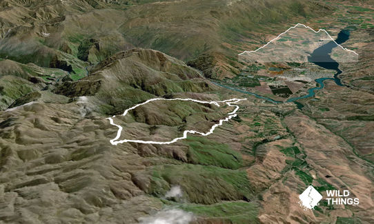
Starting at the carpark on Felton Road, follow the track through the Slucings up to Stewart Town. Cross the stile to the left of the town area and head down to Pipeclay Gully Road carpark. Head up the road and take a right hand turn at the intersection. About 50m onwards lake a left in through the Tennacreif Wines gate (public right of way) and follow the gravel road through which then turns on to a wee access track that passes through a few gates.

After the second gate, hop over the little stream and then take a left up the road up the hill. At the top of this small rise you'll see the Carricktown track carpark. Follow the Carricktown track uphill for the next 7.5km up past the Young Australian Water Wheel (you'll pass it on your left). You're on the look out for a DOC sign on your right which points you towards the Potters Creek reserve. Follow this track for 200m, jump the gate and then take a hard right.

Follow this fence line on your right hand side for the next 2km, these sheep tracks are the Upper Pipeclay Track. Following the tracks (go around the last big hill to the left) you'll reach a well defined farm track. Take a right and follow this towards Cromwell. Keep the fence on your right on the wee saddle and continue on a little more. You'll see a track on the other side of the fence heading up to the top of the hill, climb over and follow this track up (same route as Mt Difficulty Ascent takes if you've done that).

At the top of this hill, you reach a 4-way fence intersection. Head over towards "front left" which is the corner of the Long Gully Bluffs Conservation Area. Make your way down through this for about 2kms, with the fence on your right you'll see a stile to climb over and join a nice farm track which will lead you back down to the bottom of the hill, where you'll join the Long Gully track and back in to Stewart Town. Take a left and head back through the Sluicings to your vehicle.
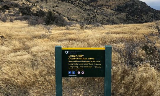
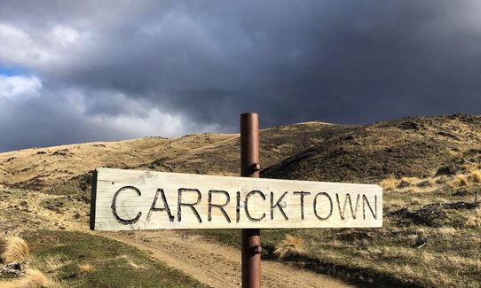
Old gold mining relics on the way up (Carricktown, Young Australian Water Wheel), lots of classic Central Otago views.

If you know of any public toilets near the trail start or on the route, please login and then let us know so we can update this section.

Plenty of parking. Well used, good to keep valuable out of sight.

8 km

9 minutes

Unknown

No

Moderate.

Patchy.

Thermal leggings, Long-sleeved thermal top, Seam-sealed waterproof jacket, Gloves, Beanie/thermal headwear, Whistle, First aid kit, Extra food for emergencies, Survival bag, Cellphone, Map, Headtorch and spare batteries

Water race on the way up to top of Carrick Range is ok to drink.

Very unpleasant in poor weather. Can be bitterly cold in the wind, as there is no cover.

Lots of spaniards and briar in the Conservation area can tear your legs to shreds...

Black Rabbit Cafe
Bannockburn
http://blackrabbit.nz/

You and Upper Pipeclay Track

As a VIP member you can record private notes for this trail, see all of your times and more.

Register Now

Already have an account? Login now

Trail Reviews

Be the first to submit a review for Upper Pipeclay Track!

Login to submit a review

Trail Running Community

Find people who are interested in or have completed this trail run.

You must register or login to view this feature.

Register Now

Overlapping Trails

These overlap with this trail to some degree. You may wish to combine them but please note that to qualify for FKTs on these runs you should record a separate activity for each.

Young Australian

Young Australian

Length: 14.8km

Level: Beginner - Intermediate

Potters Creek Loop

Potters Creek Loop

Length: 27.1km

Level: Beginner - Intermediate

Other trails nearby
Aurora and Kanuka Loops

Aurora and Kanuka Loops

Length: 16.0km

Level: Intermediate

Cairnmuir to Clyde

Cairnmuir to Clyde

Length: 26.9km

Level: Beginner - Intermediate

Mt Pisa via Tinwald Burn Ridge

Mt Pisa via Tinwald Burn Ridge

Length: 25.0km

Level: Intermediate

Mt Difficulty Loop

Mt Difficulty Loop

Length: 28.3km

Level: Intermediate

Find more trails and peaks nearby