Last Updated: 26th Feb 2024
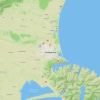
Glacier Burn Track - East Matukituki
Glacier Burn
Glacier Burn Track
Submitted by Sierra Alef-Defoe
Last Updated: 26th Feb 2024
Open
Grunt Factor: 34 ?
Gnarl Factor: 22 ?
17.8km
865m
865m


Last Updated: 26th Feb 2024
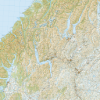
Glacier Burn Track
Submitted by Sierra Alef-Defoe
Last Updated: 26th Feb 2024
Open
Grunt Factor: 34 ?
Gnarl Factor: 22 ?
17.8km
865m
865m
Back country - remote
Out and Back
Undulating, small hills only
Native bush
Riverside
Open farmlands
Farm Road / 4WD Track
Easy Single Track
Moderate Single Track
Technical Single Track
Average Uphill Gradient: +9.7%
Average Downhill Gradient: -9.7%
VIP Feature: Send this route to your Garmin account so you can follow the course on your Garmin device.
Login as a VIP to see the trailhead information.
3:00
Slow
2:30
Moderate
2:00
Fast
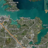
Starting with a flat easy run through farm country and finishing with native forest and glacial views, this track is a synopsis of all the contrasts of the Mt Aspiring Region. For a half-day mission, it's a good option to both get some good fast running in while still really feeling like you're getting into the backcountry. The East Matukituki is also much less frequented than the West, making it a peaceful option for those looking to avoid throngs of trampers, especially in the height of summer.
In the right conditions, there is also an option to shortcut this route by crossing the Matukituki at Cameron's Flat.
Even if taking the bridge, it would be hard to keep your feet dry on this track -- where the East Matukituki track meets the Cameron Flat Road near the river, there are a few slow-flowing/stagnant streams that must be crossed. Livestock may be present before the national park boundary. When the track goes into the forest, look for signs for the Glacier Burn track (as opposed to the other East Matukituki tracks to Junction flat etc).
If you cross a bridge over the Glacier Burn, you've gone the wrong way! The track through the forest may be unmaintained; be prepared to navigate around treefall and slips. The track terminates at the Glacier Burn with views of the Avalanche Glacier. Drinking water can be gathered from the Glacier Burn.
If you know of any public toilets near the trail start or on the route, please login and then let us know so we can update this section.
There is usually plenty of space to park. Unfortunately there is no public transport in the region. Hitchhiking is definitely a viable option in popular times of year.
16 km
44 minutes
No
No
Moderate.
Follow DOC signs for Glacier Burn rather than East Matukituki Valley tracks -- if you cross a bridge over the Glacier Burn, you're on the wrong course. Use NZ Topo 50 to check directions.
Non-existent.
Short-sleeved thermal top, Long-sleeved thermal top, Seam-sealed waterproof jacket, Gloves, Personal Locator Beacon (PLB), Whistle, First aid kit, Extra food for emergencies, Survival bag, Cellphone, Map, Gaiters
Water from the Glacier Burn should be fine when filled above park boundary, either neither the Glacier Burn Track turnoff or at the terminus of the track.
This track should be possible at all times of year if weather permits.
Crossing the Matukituki river can be hazardous -- if unsure of conditions or your own ability; use this route and take the bridge.
Fastest Known Times (FKTs)
You and Glacier Burn Track - East Matukituki
As a VIP member you can record private notes for this trail, see all of your times and more.
Already have an account? Login now
These overlap with this trail to some degree. You may wish to combine them but please note that to qualify for FKTs on these runs you should record a separate activity for each.
Send to your phone
Scan the below QR code to open this trail on your phone.

Tip: position the QR code in your phone camera screen.