Last Updated: 27th Feb 2024

Beginner - Intermediate

Save Trail Save

I've done it Done

Around Roys Bay

Waterfall Creek Track

Wanaka, Otago

Submitted by Sierra Alef-Defoe

Last Updated: 27th Feb 2024

Beginner - Intermediate

Save Trail Save

I've done it Done

Open

Grunt Factor: 15 ?

Gnarl Factor: 23 ?

15.0km

205m

195m


Login as a VIP to see driving directions, distance and time.

Trail Map

Type of Run

Urban fringe

Point to Point (one way)

Undulating, small hills only

Dog Friendly

Lakeside

Run Makeup

5%
50%
45%

Gravel Road

Easy Single Track

Moderate Single Track

Average Uphill Gradient: +2.8%

Average Downhill Gradient: -2.6%

Trailhead

Login as a VIP to see the trailhead information.

Estimated Times to Run

1:45

Slow

1:30

Moderate

1:15

Fast

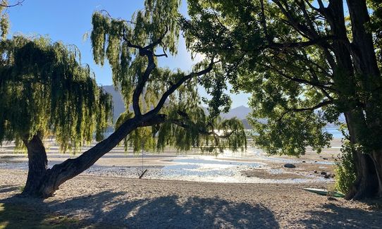
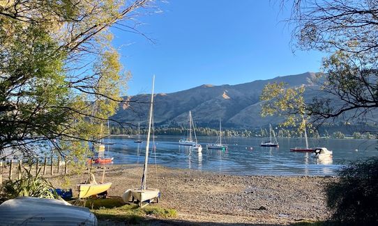
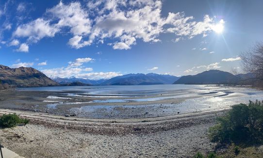
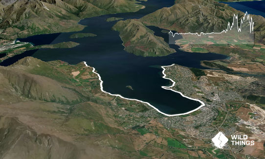
Wānaka's Roys Bay (~15 km) is a beautiful run. This route follows well-established lakefront tracks that also allow cyclists and dogs.

Starting from Beacon Point, head to the very end of Penrith Park Drive where there's a carpark. From there it's just a few hundred meters to Beacon Point itself where the run begins.

Head towards Wānaka town, passing Bremner Bay and Eely Point (bathrooms available!) and then onto town centre. This is very easy track, mostly flat and well-maintained.

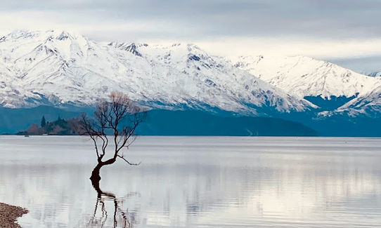
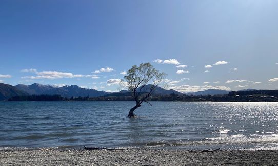
From the town centre, keep following the lakefront (more bathrooms!) towards the Wānaka tree, heading towards Waterfall Creek, and then towards Glendhu Bay.

After Ruby Island Road, the track becomes slightly more undulating and rocky as you make your way to Damper Bay.

While Damper Bay marks the end of Roys Bay, there is no way to exit the trail from here. The closest road access is either 5 km further at Glendhu Bay, or by backtracking and turning off towards Roys Peak carpark (~4 km back). Either extend your run and go for the full half-marathon distance, or take a nice 5km cool down walk at the end.

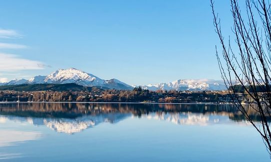
Roys Bay, Wānaka tree, views of Ruby Island

If you know of any public toilets near the trail start or on the route, please login and then let us know so we can update this section.

Parking available at the end of Pentrith Park Drive, and at Glendhu Bay or Roys Peak at the other end. As there is no public transport in Wānaka, it's probably best to park at one end and have a kind friend pick you up at the other end. Or double the run for an out-and-back!

5 km

7 minutes

Yes

No

Easy.

Generally good.

Personal Locator Beacon (PLB), Cellphone

No potable water is available between Damper Bay and Wānaka, but it's easy to refill water at drinking fountains when passing through town.

This track is possible year-round provided there is no severe weather.

Watch out for mountain bikers on the trail!

Trail Legend

Heather McDonald

Heather McDonald

has completed Around Roys Bay once in the last year.

Learn about Trail Legends.

You and Around Roys Bay

As a VIP member you can record private notes for this trail, see all of your times and more.

Register Now

Already have an account? Login now

Trail Reviews

Mostly flat, bit funny ending in the middle of no where though where you still gotta run to get out

Dan Martin

January 31, 2024

Login to submit a review

Trail Running Community

Find people who are interested in or have completed this trail run.

You must register or login to view this feature.

Register Now

Overlapping Trails

These overlap with this trail to some degree. You may wish to combine them but please note that to qualify for FKTs on these runs you should record a separate activity for each.

Ironside Hill

Ironside Hill

Length: 11.6km

Level: Beginner - Intermediate

Millennium Track: Glendhu Bay to Wānaka Tree

Millennium Track: Glendhu Bay to Wānaka Tree

Length: 13.2km

Level: Beginner - Intermediate

Other trails nearby
Cardrona to Meg Hut

Cardrona to Meg Hut

Length: 18.5km

Level: Beginner - Intermediate

Wanaka Skyline Trail

Wanaka Skyline Trail

Length: 23.4km

Level: Intermediate - Experienced

Rock of Ages

Rock of Ages

Length: 31.0km

Level: Intermediate

Fern Burn Hut

Fern Burn Hut

Length: 14.0km

Level: Beginner - Intermediate

Find more trails and peaks nearby