Last Updated: 31st Jan 2025
Southern Oban Trails
Last Updated: 31st Jan 2025
Open
Grunt Factor: 14 ?
Gnarl Factor: 12 ?
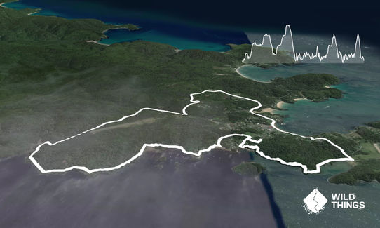
14.0km
400m
400m
90m
Last Updated: 31st Jan 2025
Last Updated: 31st Jan 2025
Open
Grunt Factor: 14 ?
Gnarl Factor: 12 ?
14.0km
400m
400m
90m
Urban fringe
Loop
Undulating, small hills only
Native bush
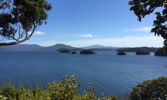
Coastal
Open farmlands
Sealed Road
Gravel Road
Farm Road / 4WD Track
Easy Single Track
Average Uphill Gradient: +6.4%
Average Downhill Gradient: -7.4%
VIP Feature: Send this route to your Garmin account so you can follow the course on your Garmin device.
Login as a VIP to see the trailhead information.
3:00
Slow
2:15
Moderate
1:30
Fast
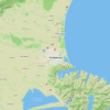
Head out of town on Horshoe Bay Road crossing two small one-lane bridges and then turn left onto Hicks road.
Follow Hicks Road all the way to the end and then turn left onto Back road (note this is a good spot for night time kiwi spotting)
Follow Back Road until it joins Main Road and turn right (If you want to do a shorter loop then you can just run straight here from town but Back Road is a nice warm up through lovely bush).
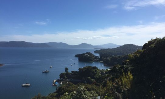
Head up Min Road until you reach the track car parks and follow the Ryans Creek track. Continue following Ryans Creek track around the back of the airport and down to the coast. Stay on the same track and try to avoid tripping as you take in the view!
When you reach the end of the trail follow the road for a short distance. You are looking for the Raroa Walk trail, it is a little hard to see but is on the corner of the 1st road on the left (the road says no entry). Follow this short but fun track up to Traill Park. Go straight across the park to Golden Bay Road. From here you can do a short but rewarding "dash" up the hill to "Observation Rock" before retracing your steps back down to Golden Bay Road and then turn left (if you have come down from Observation Rock) and follow the road down to the shore where you are looking for the Golden Bay track.
This one is great stair training! Follow the Golden Bay track all the way round to Deep Bay road, and then turn left up the hill. Just past the corner turn left onto the Peterson Hill track (also called the "path from Deep Bay"). At the end of this you will join Peterson Hill Road and follow this down and back along the waterfront into town.
If you know of any public toilets near the trail start or on the route, please login and then let us know so we can update this section.
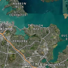
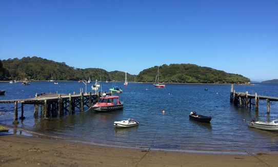
Either run from the ferry terminal or your accomodation. There is plenty of parking in Oban if you have a car.
0 km
0 minutes
Unknown
No
Moderate.
Generally good.
Long-sleeved thermal top, Seam-sealed waterproof jacket, Whistle, First aid kit, Extra food for emergencies, Cellphone, Map
Some water is available but it might be easiest to carry a small amount
Muddy at all times in patches but generally good surface
Fastest Known Times (FKTs)
You and Southern Oban Trails
As a VIP member you can record private notes for this trail, see all of your times and more.
Already have an account? Login now
I really enjoyed this run earlier this year. I would go so far as to say that those trails on the coast south of Oban are better than the Rakiura track - certainly better maintained but more scenic and more fun. I would definitely run this one again!
November 30, 2022
A great wee tour of Stewart Island, easily accessible from the town and a great variety of scenic trails. Provided a great short break from the kids 😂
February 8, 2021
These overlap with this trail to some degree. You may wish to combine them but please note that to qualify for FKTs on these runs you should record a separate activity for each.
Send to your phone
Scan the below QR code to open this trail on your phone.

Tip: position the QR code in your phone camera screen.