Last Updated: 21st Sep 2023

Beginner - Intermediate

Save Trail Save

I've done it Done

Mt. Campbell Climb

Last Updated: 21st Sep 2023

Beginner - Intermediate

Save Trail Save

I've done it Done

Grunt Factor: 32 ?

Gnarl Factor: 10 ?

28.0km

1330m

1330m

1330m


Login as a VIP to see driving directions, distance and time.

Trail Map

Type of Run

Front country - easily accessible

Out and Back

Very hilly

Native bush

Open tussock/grasslands

Run Makeup

40%
60%

Gravel Road

Farm Road / 4WD Track

Average Uphill Gradient: +10.0%

Average Downhill Gradient: -10.0%

Trailhead

Login as a VIP to see the trailhead information.

Estimated Times to Run

4:00

Slow

3:00

Moderate

2:00

Fast

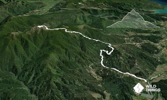
The bottom 6k from the main road are fairly straightforward incline, the remaining 8k are very steep in many places. It's a pretty easy to follow route. There is a gate to pass through that contains a number to call for access (021 438120 or 03 547 8840 - but this is best done in advance).

It is possible to drive up this road to shorten the trek but would recommend a 4WD or very sturdy car as it is steep. One section nearer the top I was told to take a left but I thought that looked pretty obvious.

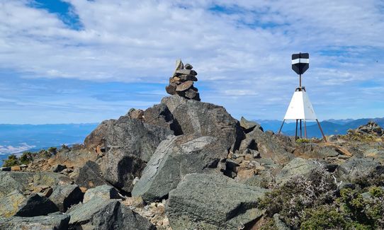
This trail includes the peak Mount Campbell.

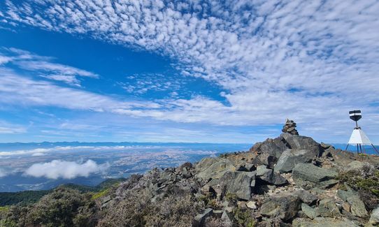
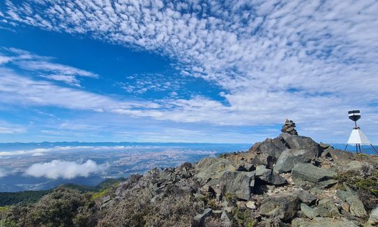
The prominence of Mt Campbell allows amazing views east across Tasman Bay, north into Golden Bay and west toward the Tasman Mountains. There is a large transmission tower at the top.

If you know of any public toilets near the trail start or on the route, please login and then let us know so we can update this section.

Not aware of any public transport but there is a small area for parking across from the entrance to Rocky River Road.

10 km

10 minutes

Unknown

Yes
Name: NL & CE Warnsley
Telephone: 021 438120

Easy.

Perfect throughout.

Waterproof leggings, Thermal leggings, Long-sleeved thermal top, Seam-sealed waterproof jacket, Windproof jacket, Gloves, Beanie/thermal headwear, Personal Locator Beacon (PLB), Whistle, First aid kit, Extra food for emergencies, Survival blanket, Cellphone, Map

Not sure that any of the ford crossings are safe to drink. Best to carry your own supply.

It would be very muddy after rain, it is very exposed at the top and can be quite windy and cold. There was a notice saying the fords could be difficult to pass in a 2wd drive car so assume they could be high after a rain.

Just your usual loose stone

Toad Hall
Motueka
https://www.toadhallmotueka.co.nz/
Excellent food and coffee, nice venue with a little green grocer market

Riverside Cafe
Motueka
http://www.riverside-cafe.co.nz
Great food and coffee and nice setting.

You and Mt. Campbell Climb

As a VIP member you can record private notes for this trail, see all of your times and more.

Register Now

Already have an account? Login now

Trail Reviews

Be the first to submit a review for Mt. Campbell Climb!

Login to submit a review

Trail Running Community

Find people who are interested in or have completed this trail run.

You must register or login to view this feature.

Register Now

Other trails nearby
Canaan to Birds Clearing

Canaan to Birds Clearing

Length: 14.0km

Level: Intermediate - Experienced

Takaka Hill Walkway

Takaka Hill Walkway

Length: 5.8km

Level: Beginner - Intermediate

Resurgence Bound

Resurgence Bound

Length: 12.4km

Level: Intermediate

Onetahuti Beach to Marahau

Onetahuti Beach to Marahau

Length: 29.0km

Level: Beginner - Intermediate

Find more trails and peaks nearby