Last Updated: 10th May 2024
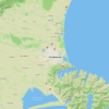
Lake Angelus Skyline Scramble, via Robert Ridge and Cascade Tracks
Robert Ride Route, Cascade Track
Submitted by Jennifer Tregurtha
Last Updated: 10th May 2024
Open
Grunt Factor: 72 ?
Gnarl Factor: 60 ?
38.3km
2085m
2085m


Last Updated: 10th May 2024
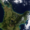
Robert Ride Route, Cascade Track
Submitted by Jennifer Tregurtha
Last Updated: 10th May 2024
Open
Grunt Factor: 72 ?
Gnarl Factor: 60 ?
38.3km
2085m
2085m
Front country - easily accessible
Loop
Undulating, some big hills
Native bush
Riverside
Lakeside
Open ridges/tops
Easy Single Track
Moderate Single Track
Technical Single Track
Untracked / Route only
Average Uphill Gradient: +10.9%
Average Downhill Gradient: -10.9%
VIP Feature: Send this route to your Garmin account so you can follow the course on your Garmin device.
Login as a VIP to see the trailhead information.
Not suitable
Slow
8:00
Moderate
6:00
Fast
The highlight of this run is the off track ridgeline scramble above Lake Angelus.
The route starts by heading straight up the Pinchgut Track from the carpark. It's a steep grunt for a couple of k's, before reaching Relax Shelter. From this point there is about 9km of beautiful ridgeline. Some sections are beautiful runnable open terrain, others are pretty scrambly through chunky rockfall. Enjoy the views from this section!
Eventually, just after the turnoff to the Speargrass Route, you come to a ridge where you get your first view down to Lake Angelus Hut. This is the point where you leave the main track. Instead of going to the hut, turn right, and head onto the ridgeline. After a couple of minutes you will reach the Lake Angelus webcam - if you time it right you might even get a selfie on the webcam! Continue to follow this ridge around until you intersect the poled Mt Cedric Route. This section is not runnable, so allow plenty of time (2km/h speed is a reasonable pace for this section). It may well be snowy too, even in summer. There are a few sections on this ridgeline that require some almost bouldering moves - nothing too challenging, but be prepared. You will need to be confident with some exposure and on loose terrain. There are probably options to avoid the worst bits by sidling on the Western Side where needed. There are some sections where it's safer to go one at a time to avoid dislodging loose rocks onto each other.
Follow the Mt Cedric route for 1km back to Lake Angelus Hut and enjoy a well deserved lunchbreak.
Follow the Cascade Track all the way down the valley to the Lower Travers Valley track. The top section is steep and technical, but the bottom half is a gorgeous flowy beech forest descent - enjoy! At the bottom, turn left and follow it out to Coldwater Hut. Fill up with water, then follow the Lakeside track to the intersection with Paddys Track. Turn left onto this, and make your way up a short but grunty final wee steep push. At the next intersection turn right and follow this out to the carpark.
This trail includes the peaks Mount Robert, Julius Summit and Flagtop.
Lake Angelus, Whisky Falls, 3 DOC Huts
If you know of any public toilets near the trail start or on the route, please login and then let us know so we can update this section.
Plenty of parking in two large carparks at the end of the road. A loop track so no shuttle logistics needed.
7 km
14 minutes
No
No
Moderate.
Non-existent.
Waterproof leggings, Thermal leggings, Lightweight fleece top, Long-sleeved thermal top, Seam-sealed waterproof jacket, Windproof jacket, Gloves, Beanie/thermal headwear, Personal Locator Beacon (PLB), Whistle, First aid kit, Extra food for emergencies, Survival bag, Cellphone, Map, Headtorch and spare batteries, Crampons / microspikes (for winter conditions)
Water available at Lake Angelus and Coldwater Huts, and you're beside a lake or river for the whole second half of the run, although use your judgement as to whether it's drinkable.
Risk of snow in any season, but especially in winter, this is an alpine route and not suitable as a day run. A very exposed ridgeline that would only be suitable in good weather considering the lightweight gear typically carried by runners.
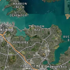
Alpine Lodge
St Arnaud
https://www.alpinelodge.co.nz/
Pizza... you've earned it
Fastest Known Times (FKTs)
You and Lake Angelus Skyline Scramble, via Robert Ridge and Cascade Tracks
As a VIP member you can record private notes for this trail, see all of your times and more.
Already have an account? Login now
These overlap with this trail to some degree. You may wish to combine them but please note that to qualify for FKTs on these runs you should record a separate activity for each.
Send to your phone
Scan the below QR code to open this trail on your phone.

Tip: position the QR code in your phone camera screen.