Front country - easily accessible
Out and Back
Very hilly
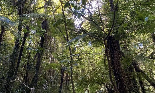
Native bush
Open ridges/tops
Farm Road / 4WD Track
Easy Single Track
Moderate Single Track
Technical Single Track
Average Uphill Gradient: +17.2%
Average Downhill Gradient: -16.2%
Login as a VIP to see the trailhead information.
1:40
Slow
1:10
Moderate
55:00
Fast
The most efficient official trail up. A pretty spicey climb up to get the lungs working and a great way to break up a road trip through Karangahake Gorge.
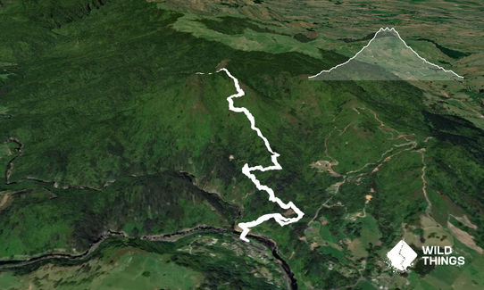
Starting at the main visitors centre car park, you cross the swing bridge and head towards the green DOC signs. From this point, take the upper Right hand turn, the Scotsman Gully track. This track has a little stream crossing and then pops up onto a 4WD track. Take a left turn heading up the 4WD track after cleaning your shoes at the station.
After about 800m of climbing up the 4WD track, you will come to a junction where you take a sharp right turn towards the summit rather than continuing up the road. This corner has DOC signage and can send you a few directions to get to the summit, but for this route you want to take the right turn.
After a further 800m of climbing, you will come to another turn off where the main track continues on an almost 90 degree turn to the right, and our trail takes a left turn.
From here it's a straight forward (and spicey) ascent up on a more technical trail, and after a kilometer of climbing you will pop out to the ridgeline. Take a sharp left turn and after a technical 300m you will pop up to the true summit.
Admire the view, grab your selfie, and then send it on the downhill right back down where you've come from.
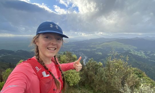
This trail includes the peak Karangahake.
The summit gives you an epic 360 degree view of the Kaimai-Mamaku's, and when you're stopped to catch your breath there are some epic views back down towards State Highway 2 and the Karangahake Gorge.
If you know of any public toilets near the trail start or on the route, please login and then let us know so we can update this section.
Parking available right at start, although often quite a packed carpark when tourist season is in full swing. The parking here has security cameras so quite a secure carpark.
2 km
3 minutes
No
No
Moderate.
Very patchy.
Seam-sealed waterproof jacket, Personal Locator Beacon (PLB), Whistle, First aid kit, Extra food for emergencies, Cellphone, Map
Water available at the start at the carpark, however not available during the route.
Can get quite muddy after rain and during winter.
The final section to the summit can get quite gusty and cold on a winters day.
Crossing the initial stream can be a bit difficult after heavy rain.
Trail Legend
Fastest Known Times (FKTs)
You and Can you Karanga-hack it
As a VIP member you can record private notes for this trail, see all of your times and more.
Already have an account? Login now
Bust of a climb, wicked decent, and amazing views. Thanks for adding it Caitlin! After the beginning few hundred metres you hit the road, and I got tricked into thinking it will be a easy climb, but once I started the 'goat track' single track madness near the ridgeline all of my decorum went out the window and there was much swearing! The landscape is very dramatic and so even though you're only 500m at the top it feels a lot higher and wonderfully epic.
December 9
These overlap with this trail to some degree. You may wish to combine them but please note that to qualify for FKTs on these runs you should record a separate activity for each.