Last Updated: 9th Apr 2024

Beginner

Save Trail Save

I've done it Done

Waikato River Trails - Atiamuri to Whakamaru

Tokoroa, Waikato

Submitted by Linda Downes

Last Updated: 9th Apr 2024

Beginner

Save Trail Save

I've done it Done

Open

Grunt Factor: 19 ?

Gnarl Factor: 11 ?

21.0km

180m

200m

281m


Login as a VIP to see driving directions, distance and time.

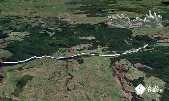
Trail Map

Type of Run

Front country - easily accessible

Point to Point (one way)

Undulating, small hills only

Plantation/exotic forest

Riverside

Lakeside

Run Makeup

1%
99%

Sealed Road

Easy Single Track

Average Uphill Gradient: +1.9%

Average Downhill Gradient: -2.7%

Trailhead

Login as a VIP to see the trailhead information.

Estimated Times to Run

3:15

Slow

2:25

Moderate

1.45

Fast

This run can be done either way as a point to point or an out an back, you can turn around at any time and head back to your car. But you need to do the whole thing as described to claim your Wild Explorer Points!

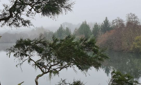
Starting from Atiamuri the trail is really easy, minimal hill (mostly flat) well maintaned and mostly gravel track, flowing downstream with the Waikato river, you will run through beautiful parts with old pines hanging over the river bank for the first 7km. You will then make your way past some farmland and a few boardwalks through wetland area until you reach the Dunhams reserve carpark/campground (which is also a great place to park your car and head out for a run.)

From Dunhams Reserve you will continue on well maintained, easy trail with the hills becoming more undulating. There is an option to go up some stairs, highly recommended as the view is lovley. Keep following the trail until you reach Whakamaru dam.
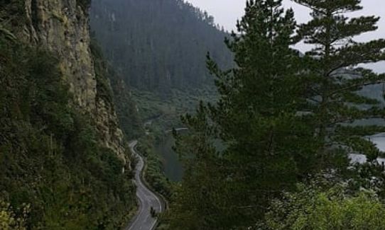
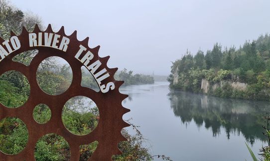
Following Waikato River Views of Mount Pohaturoa

If you know of any public toilets near the trail start or on the route, please login and then let us know so we can update this section.

Lots of parking for more than 30 cars. Safe area as it is just off State Highway 1 as you pull onto Ongaroto road it is on the right hand side.

26 km

19 minutes

No

No

Easy.

Lots of signs along the way. Follow the blue markers with River trail symbol

Patchy.

Short-sleeved thermal top, Long-sleeved thermal top, Windproof jacket, Whistle, First aid kit, Extra food for emergencies, Cellphone, Map

No drinking water

Busy trail in summer months

Lots of mountain bikers, mostly on weekends

Trail Legend

Jane McAlpine

Jane McAlpine

has completed Waikato River Trails - Atiamuri to Whakamaru twice in the last year.

Learn about Trail Legends.

You and Waikato River Trails - Atiamuri to Whakamaru

As a VIP member you can record private notes for this trail, see all of your times and more.

Register Now

Already have an account? Login now

Trail Reviews

As a slow beginner I loved this trail. No crossing roads. As always got lost at the start when I ran for 1.5 km along the road before I had to run back to the start and head left down to the river then right onto the trail lol. Deceptively flat. Fell at one point on a slippery wooden creek board walk but out of the blue a cyclist happened by to witness my embarrassment! Only saw cyclists who mostly rang their bells. One called out 'here comes a walker!' To his following cycle friends. His friend was nice enough to correct him with 'runner'! Definitely recommend although hard to con non runner into waiting the 3+ hours to collect from other end.... many bribes given

Sarah Jenkins

June 5, 2021

Login to submit a review

Trail Running Community

Find people who are interested in or have completed this trail run.

You must register or login to view this feature.

Register Now

Other trails nearby
Tour of Cougar park

Tour of Cougar park

Length: 14.0km

Level: Beginner

Tokavegas trails

Tokavegas trails

Length: 21.0km

Level: Beginner - Intermediate

Cougar Park Dash

Cougar Park Dash

Length: 3.2km

Level: Beginner

Find more trails and peaks nearby