Last Updated: 7th Dec 2024

Beginner - Intermediate

Save Trail Save

I've done it Done

Swingbridges & Tunnels

Waihi, Waikato

Submitted by Mike Tennent

Last Updated: 7th Dec 2024

Beginner - Intermediate

Save Trail Save

I've done it Done

Notice More info

Grunt Factor: 28 ?

Gnarl Factor: 49 ?

20.5km

625m

625m

517m


Login as a VIP to see driving directions, distance and time.

Trail Map

Type of Run

Front country - easily accessible

Loop

Undulating, some big hills

Native bush

Riverside

Run Makeup

5%
5%
20%
45%
25%

Gravel Road

Farm Road / 4WD Track

Easy Single Track

Moderate Single Track

Technical Single Track

Average Uphill Gradient: +13.1%

Average Downhill Gradient: -13.1%

Trailhead

Login as a VIP to see the trailhead information.

Estimated Times to Run

4:00

Slow

2:45

Moderate

1:45

Fast

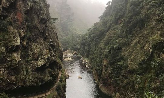
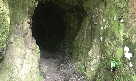
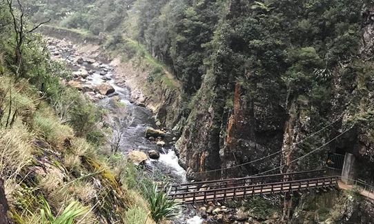
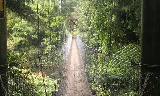
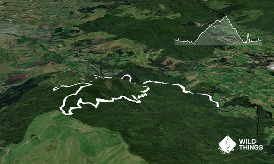
Starting at the campground follow the trail and cross the first swingbridge, a bit further along you will see the exit to the Dubbo Trail on your left... run past that and over the second swingbridge. Shortly after that you will come to the main tunnel... you will need either a headlamp or a good torch for this, the floor is rocky, undulating and has many many puddles of varying depth.

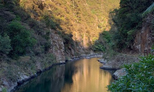
Out the other side stop briefly and look to your left to see the river coming out of the rock... worth a snap!

Follow the trail for a while of pretty cruisy running until you see a set of steps on your right... head up them and break out the light again and head into the Windows Trail... again it is worth taking your time and checking out the views from the side trails.

Once through the tunnels, take the main trail that veers left and follow that down and around to the next swingbridge. Over the Swingbridge and up onto the trail and a little left there is a small narrow trail that leaves the main trail heading up the hill - if you find yourself on a well formed trail going either way then you have missed it (easy to do)... so double back and look for the small trail.

Follow that up all the way until it spits you out on the road at the top and turn left. Carry on up the road, go straight past the first road that come in from the right (you will come out of this later) and watch for the next track to the right... signposted as County Road. Head up here, a little rocky and steep at first, it quickly settles to a very runnable trail all the way to the top of the hill.

There is only one trail off this before the top, you will pass the top of the Dubbo Track that we passed the bottom of earlier. More about that later, but for now, run straight past.

Eventually at the top you will come to a 3 way junction, off to the left is the Mangakino Pack Track (great route but not today)... the straight ahead trail and the one to the right both lead to the same spot so take you choice. The right hand trail is slightly shorter but quite a bit more technical... on this run we headed straight ahead.

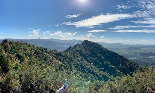
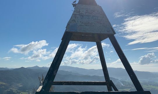
At the next intersection you have the choice of a side trip to the trig, great views and worth it if you are not in a hurry. Otherwise take the other trail at the sign and start heading down the hill... be careful, it can be very slippery if there has been rain. From here just follow the main trail until you come out the bottom onto the road you ran earlier. We had planned to run back up the hill and down Dubbo which would have made this the Xterra National Course, however on this day there had been a lot of rain and the trail can be very muddy and has a fast flowing stream crossing that we decided to skip. So from this point we retraced our steps to the bottom of the hill.

Then instead of going back over the swingbridge we took the right hand trail and followed it with the river on our left until we came to another swingbridge which we crossed, just after that we passed the steps to the Windows on out left and then followed the trail back to the start.
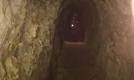
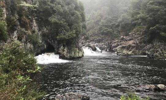
A long walking tunnel created with pickaxes and dynamite many years ago plus several other mining tunnels. Mine workings and many old mine shafts.

If you know of any public toilets near the trail start or on the route, please login and then let us know so we can update this section.

There is usually plenty of parking at the Dickey Flat Campsite and because there are usually multiple cars and some campers, thing are always pretty secure.

12 km

13 minutes

No

No

Moderate.

Once out of the Windows Trail take the swingbridge straight in front of you and then take your time to find the small trail up the hill.

Patchy.

Long-sleeved thermal top, Seam-sealed waterproof jacket, Gloves, Whistle, First aid kit, Extra food for emergencies, Cellphone, Map, Headtorch and spare batteries

Available for much of the run

Clay base means that the downhill can be treacherous after rain.

Many places, rocky trail sections, the long tunnel and the downhill if wet. If you decide to run Dubbo it is highly technical and the stream crossing can be tricky

Trail Legend

Raewyn Peters

Raewyn Peters

has completed Swingbridges & Tunnels once in the last year.

Learn about Trail Legends.

You and Swingbridges & Tunnels

As a VIP member you can record private notes for this trail, see all of your times and more.

Register Now

Already have an account? Login now

Trail Reviews

Great trail, the notes and info on rainy season big rivers paid massive dividends and were really useful. A beautiful run that takes in great vantage points and really runnable sections especially on the graded uphill section

jack darlington

June 29, 2020

A great run in a great location. There were a number of trail closures from mining, Kauri die back and track maintenance but managed to create a route on the day. The trig is worth the effort.

Allan Haydock

April 29, 2019

Login to submit a review

Trail Running Community

Find people who are interested in or have completed this trail run.

You must register or login to view this feature.

Register Now

Overlapping Trails

These overlap with this trail to some degree. You may wish to combine them but please note that to qualify for FKTs on these runs you should record a separate activity for each.

Karangahake Gold

Karangahake Gold

Length: 17.0km

Level: Beginner - Intermediate

Ohinemuri to Waitawheta

Ohinemuri to Waitawheta

Length: 24.5km

Level: Beginner

Can you Karanga-hack it

Can you Karanga-hack it

Length: 7.0km

Level: Intermediate

Other trails nearby
Kaimai Killer

Kaimai Killer

Length: 42.0km

Level: Intermediate - Experienced

Karangahake Mountain Run

Karangahake Mountain Run

Length: 10.3km

Level: Intermediate - Experienced

Waitawheta Tramway - Bogeys and Bluffs

Waitawheta Tramway - Bogeys and Bluffs

Length: 19.0km

Level: Beginner

Find more trails and peaks nearby