Last Updated: 21st May 2024

Beginner - Intermediate

Save Trail Save

I've done it Done

Te Whiti Riser

Lower Hutt, Wellington

Submitted by Clive Start

Last Updated: 21st May 2024

Beginner - Intermediate

Save Trail Save

I've done it Done

Open

Grunt Factor: 11 ?

Gnarl Factor: 47 ?

8.2km

250m

250m

252m


Login as a VIP to see driving directions, distance and time.

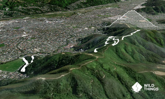
Trail Map

Type of Run

Urban fringe

Loop

Undulating, small hills only

Dog Friendly

Native bush

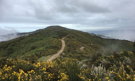
Open ridges/tops

Run Makeup

45%
30%
25%

Easy Single Track

Moderate Single Track

Technical Single Track

Average Uphill Gradient: +14.2%

Average Downhill Gradient: -14.2%

Trailhead

Login as a VIP to see the trailhead information.

Estimated Times to Run

1:15

Slow

0:55

Moderate

0:35

Fast

The run starts through a narrow "gate", designed to stop people taking anything bigger than a bike up the Riser. A couple of a hundred metres up you come to a crossroads where you can choose the firebreak if you want steep (that's left), or can head down right to get out of the bush, or (this is the correct way for the Riser) just go straight ahead to carry on up the Riser. At about 800m you will cross the Firebreak climb.

Carry on and at 2km you will get to a wooden walkway/viewing platform. Carry on up, and a bit over 3km you will get to a fork, left/North or right/South. Either way will take you up to the ridge track and if you've gone left, turn right at the top, or if you've gone right, turn left at the top. There is about 800m between the top of left or right. I usually go North, turn left, then come down the South exit. The segment is called TeWhiti Cruiser Up n Down, although there are other segments too.

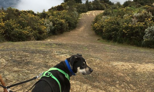
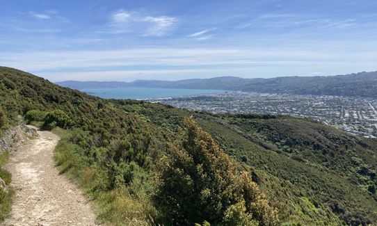
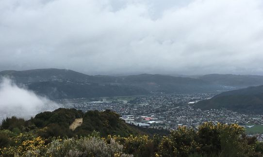
Lovely bush, about 2km up is a viewing platform, on the way up and down there are viewing options quite often. There is nothing too steep.

There is a public toilet on the south side of Te Whiti Park.

There is a parking spot on Riverside Drive, Waiwhetu, with space for about 8 vehicles. There is also on street parking available. I generally start the run from just over the bridge from the car park.

3 km

5 minutes

Yes

No

Moderate.

About 200m up, go straight over the track. Just after 3km up, you get to a fork, can got left or right. Trickiest bit is the ridge and finding the down options. There is about 800m between the 2 tops. The exits are not labelled, but do look like exits.

Perfect throughout.

Long-sleeved thermal top, Seam-sealed waterproof jacket, Beanie/thermal headwear, Whistle, First aid kit, Cellphone, Map, Headtorch and spare batteries

Take your own water, there is none availabel on the track.

Afetr rain it cann be quite muddy. If nto muddy, road shoes are ok, if muddy, trail shoes.

There are places where the track is quite rocky.

Cafe on Guthrie
58 Guthrie Street, Waterloo, Lower Hutt
https://www.facebook.com/Café-on-Guthrie-St-176977532928614/
Closest option.

Trail Legend

Cullum Mangin

Cullum Mangin

has completed Te Whiti Riser 6 times in the last year.

Learn about Trail Legends.

You and Te Whiti Riser

As a VIP member you can record private notes for this trail, see all of your times and more.

Register Now

Already have an account? Login now

Trail Reviews

This is a great track regardless of your running abilities - it's a gentle ascent that's never really too steep, but there's no flat ground so it can turn into a bit of a slog. The views make it all worth it, and it provides great access to the firebreaks along the tops.

Seth Zorn

February 9, 2022

Awesome run - easy enough gradient to run hard up and cruise all the way down. Great fun! Lots of photo opportunities of great views over the Hutt Valley.

David Hosking

December 7, 2021

Lovely steady climb up through the bush with steadily emerging views of the valley as you climb - and a fast run down (for me!) too. Great in dry conditions.

Karen Spencer

March 21, 2021

This was my favorite running track while I lived in the area. I started running it while they were still building it and used to only be able to go up to the bridge half way, great way to get to the fire tracks on top and run along for a while then back the way you had come up. Great for hill repeats as well, highly recommend this track to anyone at any level.

Joce Jones

January 28, 2020

Login to submit a review

Trail Running Community

Find people who are interested in or have completed this trail run.

You must register or login to view this feature.

Register Now

Overlapping Trails

These overlap with this trail to some degree. You may wish to combine them but please note that to qualify for FKTs on these runs you should record a separate activity for each.

Te Whiti Firebreak Calf Burn

Te Whiti Firebreak Calf Burn

Length: 8.0km

Level: Beginner - Intermediate

Waddington Loop of Wander

Waddington Loop of Wander

Length: 10.0km

Level: Beginner - Intermediate

Other trails nearby
Mukamuka Munter

Mukamuka Munter

Length: 30.0km

Level: Intermediate

Eastbourne Ridge Loop

Eastbourne Ridge Loop

Length: 20.5km

Level: Intermediate

Lighthouses and Lakes

Lighthouses and Lakes

Length: 23.5km

Level: Intermediate

Belmont Bash

Belmont Bash

Length: 11.0km

Level: Beginner

Find more trails and peaks nearby