Last Updated: 10th Jun 2024

Intermediate

Save Trail Save

I've done it Done

Pinnacle Ridge Plus

Masterton, Wellington

Submitted by Emily Shrosbree

Last Updated: 10th Jun 2024

Intermediate

Save Trail Save

I've done it Done

Open

Grunt Factor: 55 ?

Gnarl Factor: 65 ?

23.2km

1395m

1395m

1230m


Login as a VIP to see driving directions, distance and time.

Trail Map

Type of Run

Back country - remote

Loop

Very hilly

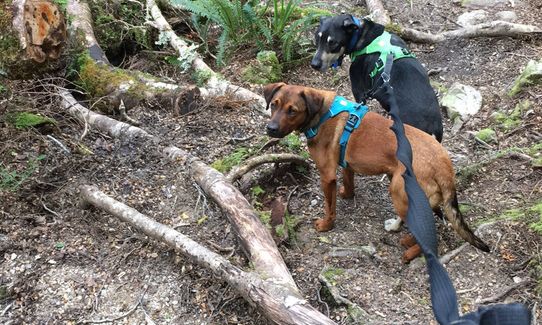
Dog Friendly

Native bush

Open ridges/tops

Run Makeup

30%
20%
25%
25%

Easy Single Track

Moderate Single Track

Technical Single Track

Untracked / Route only

Average Uphill Gradient: +16.2%

Average Downhill Gradient: -13.7%

Trailhead

Login as a VIP to see the trailhead information.

Estimated Times to Run

4:30

Slow

3:30

Moderate

2:40

Fast

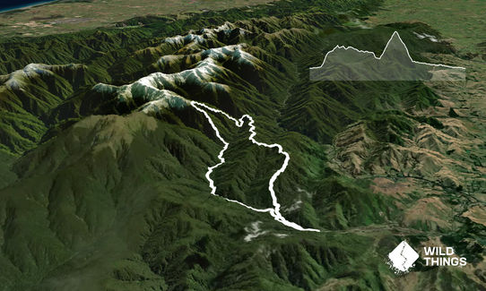
After leaving Holdsworth Lodge, and just before you cross the bridge over the Atiwhakatu Stream there is a small track off to the right. It is well-trodden but unmarked. Follow this track along the stream to start with, then as it climbs up to Pinnacle (.877). There are multiple traps along this track which is well defined but not officially marked.

From Pinnacle, there are a couple of cairns which guide you to the continuation of the track to .862, then take care to follow the track to the left from .862 towards .846. From .846 you travel almost due north down the ridge to meet the Barton Track, just before it intersects wit the Baldy Track. The section between .846, .730 and where you join the marked track switches between being very obvious and very tricky to follow. There are old track markers in places.

Once on the Barton Track, turn left and follow it down a short distance to the junction with the Baldy Track, then left again to descend to the swingbridge over the river. The section of track along the river here is relatively rough and rooty. At the first junction, which is signed, turn right and follow the track straight up to Jumbo Hut. This is well marked but there is some tree fall to negotiate. There is a short section of exposed tops as you pop out of the bushline before you reach Jumbo Hut. From Jumbo Hut follow the well marked Raingauge Spur track down to Atiwhakau Hut. This is a steep descent. Then it's a gentle roll out along the Atiwhakatu Track back to the Holdsworth Lodge to finish the loop.
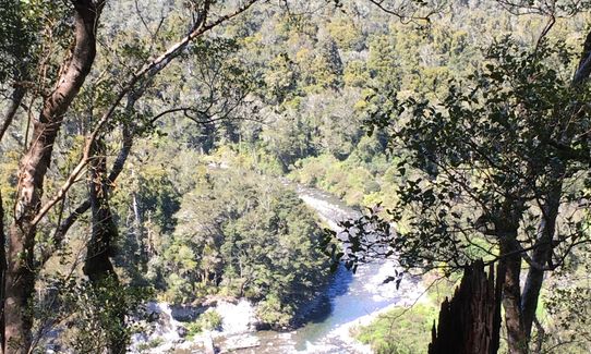
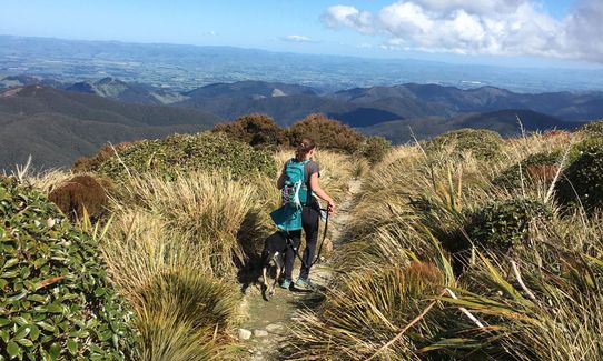
Views of both Powell and Jumbo Hut Swingbridges

If you know of any public toilets near the trail start or on the route, please login and then let us know so we can update this section.

There is lots of parking at the road end. It's a popular entrance point to the Tararua. There is a warden based at the campsite at the road end. No public transport.

22 km

23 minutes

Yes

No

Hard.

The first section along Pinnacle Ridge is on unmarked track. There is a good foot trail but it can be difficult to follow in places for inexperienced route-finders so keep your eyes out for the old markers.
Check your direction at .862, as you want to be heading towards .846 rather than straight on to .800.
Once you hit the marked Barton Track then navigation is easy.

Very patchy.

Thermal leggings, Long-sleeved thermal top, Seam-sealed waterproof jacket, Windproof jacket, Gloves, Beanie/thermal headwear, Personal Locator Beacon (PLB), Whistle, First aid kit, Extra food for emergencies, Survival bag, Cellphone, Compass, Map, Headtorch and spare batteries, Gaiters

There is a water tap by the toilets at the Holdsworth Road End, and a water tank at Jumbo Hut.
There is also the option to fill up from Atiwhakatu Stream before you cross the swingbridge.

It's the Tararuas, so it can be very muddy at any time of year. And the short section above the bushline can be very exposed to strong, cold winds.

The Clareville Bakery
Clareville on SH2
https://theclarevillebakery.co.nz/
Excellent doughnut and pie selection.

Wild Oats Cafe
Carterton
http://www.wildoatscafe.co.nz/
Good coffee and other baked goods.

Trail Legend

BT

BJ T

has completed Pinnacle Ridge Plus once in the last year.

Learn about Trail Legends.

You and Pinnacle Ridge Plus

As a VIP member you can record private notes for this trail, see all of your times and more.

Register Now

Already have an account? Login now

Trail Reviews

In absolutely love this track as it takes you through beautiful bush and gives your quads, hamies and glutes a right work out! I also like it because you are very unlikely to come across many people until you get down to the Atiwhakatu track. It`s 15 min drive from my house so that`s a bonus :-)

Rita Onosa

January 6, 2020

Login to submit a review

Trail Running Community

Find people who are interested in or have completed this trail run.

You must register or login to view this feature.

Register Now

Overlapping Trails

These overlap with this trail to some degree. You may wish to combine them but please note that to qualify for FKTs on these runs you should record a separate activity for each.

Jumbo - Holdsworth Circuit

Jumbo - Holdsworth Circuit

Length: 24.0km

Level: Intermediate - Experienced

Hooper Loop - Mt Holdsworth

Hooper Loop - Mt Holdsworth

Length: 12.0km

Level: Beginner - Intermediate

Kaituna to Holdsworth Lodge

Kaituna to Holdsworth Lodge

Length: 21.4km

Level: Intermediate

Atiwhakatu Hut

Atiwhakatu Hut

Length: 14.0km

Level: Beginner - Intermediate

Other trails nearby
Mt Clyde

Mt Clyde

Length: 4.3km

Level: Beginner

Waipoua River & Henley Lake Trail

Waipoua River & Henley Lake Trail

Length: 10.0km

Level: Beginner

Holdsworth to Kaitoke

Holdsworth to Kaitoke

Length: 34.6km

Level: Intermediate - Experienced

Blue Range Hut

Blue Range Hut

Length: 7.7km

Level: Intermediate

Find more trails and peaks nearby