Last Updated: 13th Jun 2024

Intermediate - Experienced

Save Trail Save

I've done it Done

Kelly Range Ramble

Carroll Hut to Taipo River

Taipo Valley Track

Last Updated: 13th Jun 2024

Intermediate - Experienced

Save Trail Save

I've done it Done

Grunt Factor: 51 ?

Gnarl Factor: 55 ?

23.5km

1350m

1570m


Login as a VIP to see driving directions, distance and time.

Trail Map

Type of Run

Back country - remote

Point to Point (one way)

Very hilly

Native bush

Riverside

Open tussock/grasslands

Open ridges/tops

Run Makeup

25%
30%
45%

Farm Road / 4WD Track

Moderate Single Track

Technical Single Track

Average Uphill Gradient: +10.7%

Average Downhill Gradient: -12.4%

Trailhead

Login as a VIP to see the trailhead information.

Estimated Times to Run

Not suitable

Slow

5:00

Moderate

3

Fast

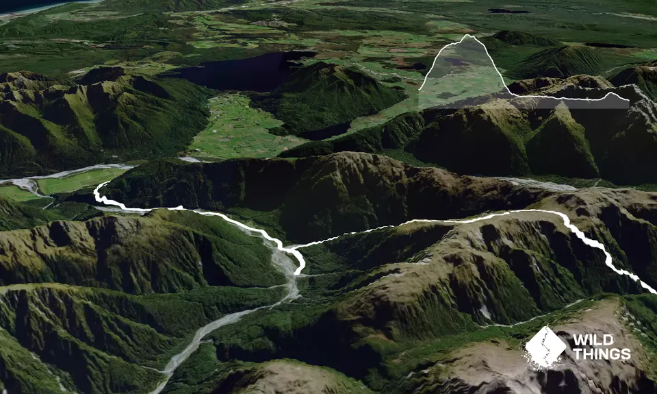
This route requires a car drop or a short hitch back to the start.

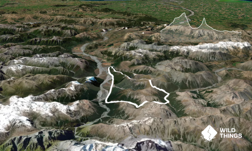
Start at the layby after the first bridge after the Otira Township. There is a parking spot on the left after the bridge (about 100m off the road). Head up to Carroll hut from here. This is an approximately 3km 600m climb.

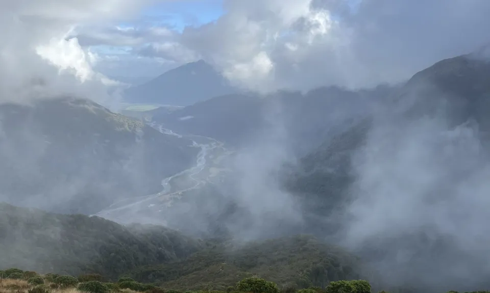
From the hut continue up and along the tops. On a nice sunny day there are some nice tarns and views to keep you distracted along the way but it can also be very cold and claggy so be prepared for all weather! The track along the tops is well marked and the track is mostly easy to follow.

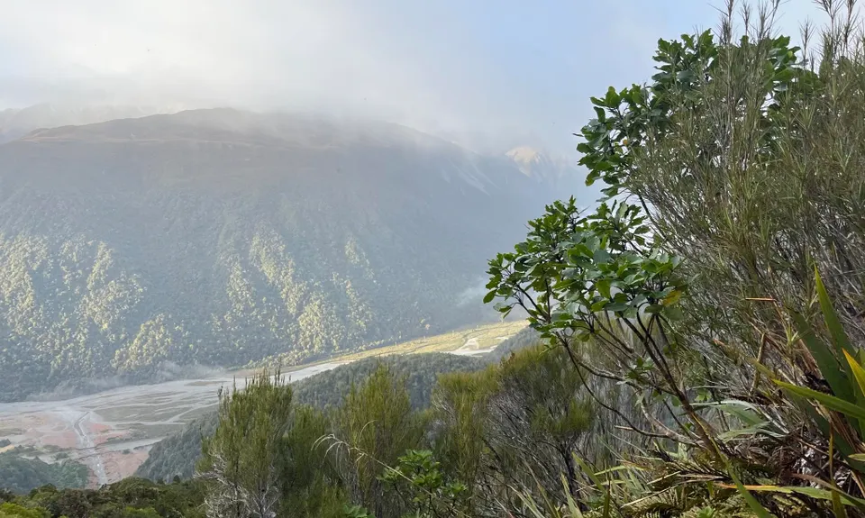
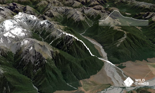
After about 4kms take the track that leads down to the Taipo River (which on a good day you should be able to see in the distance). From here the track starts off fairly straightforward but then becomes increasingly steeper as you head down towards the scrub and bush. It is about a 1000m drop back down to the river bed.

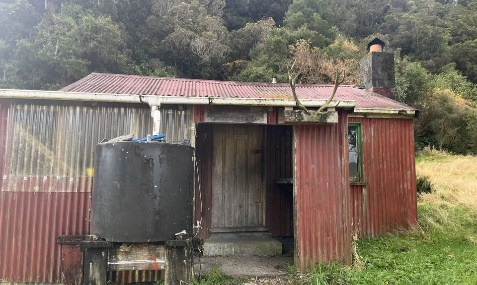
When you reach the river it is a short diversion up the Taipo to bag a couple of huts (The historic Dillions Homestead and the new Dillions Hut, both popular with hunters). You can explore further up the valley or turn around and head down the Taipo towards the main highway.

After crossing 6 mile creek you can follow the 4WD track all the way back and it is an easy exit out back to the car or catch a ride back to the start.

Carroll Hut, Dillions Historic Homestead, Dillions Hut.

Nearest public toilets at Arthurs Pass.

Parking area at Kelly's Creek and just before the Taipo river end (if you are heading West).

17 km

17 minutes

Unknown

No

Moderate.

Start and end points can be tricky to find, especially the Taipo end. The Taipo end carpark is East of the river not at the river end and easy to overshoot.

Patchy.

Waterproof leggings, Thermal leggings, Lightweight fleece top, Long-sleeved thermal top, Seam-sealed waterproof jacket, Windproof jacket, Gloves, Beanie/thermal headwear, Personal Locator Beacon (PLB), Whistle, First aid kit, Extra food for emergencies, Survival bag, Survival blanket, Cellphone, Compass, Map, Headtorch and spare batteries, Crampons / microspikes (for winter conditions)

Rivers and creeks along the way although limited along the tops other than a few tarns.

Mid winter dangers - snow and ice highly likely along the tops.

You and Kelly Range Ramble

As a VIP member you can record private notes for this trail, see all of your times and more.

Register Now

Already have an account? Login now

Trail Reviews

Be the first to submit a review for Kelly Range Ramble!

Login to submit a review

Trail Running Community

Find people who are interested in or have completed this trail run.

You must register or login to view this feature.

Register Now

Overlapping Trails

These overlap with this trail to some degree. You may wish to combine them but please note that to qualify for FKTs on these runs you should record a separate activity for each.

Kelly Tops

Kelly Tops

Length: 12.7km

Level: Beginner - Intermediate

Other trails nearby
Avalanche Peak - Crow River

Avalanche Peak - Crow River

Length: 20.0km

Level: Intermediate - Experienced

Encompassing Arthur's Pass

Encompassing Arthur's Pass

Length: 60.0km

Level: Very Experienced

Rome Ridge/Rough Creek Alpine Circuit

Rome Ridge/Rough Creek Alpine Circuit

Length: 16.0km

Level: Experienced

Polar Discovery

Polar Discovery

Length: 25.0km

Level: Experienced

Find more trails and peaks nearby