Last Updated: 18th Apr 2024
Klondyke Loop
Klondyke Spur and Klondyke Valley tracks
Submitted by Steve Beatson
Last Updated: 18th Apr 2024
Open
Grunt Factor: 34 ?
Gnarl Factor: 76 ?
13.0km
1070m
1065m


Last Updated: 18th Apr 2024
Klondyke Spur and Klondyke Valley tracks
Submitted by Steve Beatson
Last Updated: 18th Apr 2024
Open
Grunt Factor: 34 ?
Gnarl Factor: 76 ?
13.0km
1070m
1065m
Front country - easily accessible
Loop
Undulating, some big hills
With permit
Native bush
Open ridges/tops
Moderate Single Track
Technical Single Track
Untracked / Route only
Average Uphill Gradient: +16.5%
Average Downhill Gradient: -16.4%
VIP Feature: Send this route to your Garmin account so you can follow the course on your Garmin device.
Login as a VIP to see the trailhead information.
Not suitable
Slow
5:30
Moderate
3:45
Fast
A great day out starting with a steep climb up through the bush, some great ridge travel before descending to some beautiful tarns and out along the valley through classic mossy West Coast forest.
A few hundred metres after leaving the carpark where the track splits, take the left track signposted Klondyke Spur (you will return on the Klondyke Valley track to the right). Travel steeply uphill for approximately 2km and 600m until you reach the bushline and get your first taste of the amazing views - not much running to be had here.
Travel along the ridge for approx. 2km - travel is straightforward and easy to follow. Do not drop off ridge until in a saddle with tarns are directly on your right, as shown in gpx. Dropping off too soon can result in getting bluffed. Make your way down to the tarns, stopping for a refreshing dip if you want to cool off, before going round the north side of the main tarn and keeping on the true left of the outlet stream, aiming for a finger of tussock/rocks between the bush. This is quite a steep 100m descent, but isn't technical.
Follow a faint track through the tussock looking out for the DoC orange triangle showing where to enter the bush. From here it is a fun and largely runnable 4km run back to the car. The last 1.5km can be quite muddy just to remind you that you are near the West Coast. A couple of hundred metres before the end you come to the Klondyke Spur/Klondyke Valley junction.
Nice ridge travel, classic West Coast forest, waterfall and tarns.
If you know of any public toilets near the trail start or on the route, please login and then let us know so we can update this section.
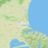
Car parking for approx 10 cars. Unlikely to be full.
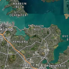
26 km
21 minutes
With Permit
No
Easy.
Navigation is largely straight forward. Do not drop off ridge towards tarns too early as you can get bluffed. After traversing Pt 1,541 descent to a saddle at 1,430m and the tarns are directly on your right (east). Descend down tussock and rocks to tarns.
After passing tarns keep on true left of outlet stream, descending down a steep section between two patches of bush.
Very patchy.
Waterproof leggings, Thermal leggings, Lightweight fleece top, Long-sleeved thermal top, Seam-sealed waterproof jacket, Gloves, Beanie/thermal headwear, Personal Locator Beacon (PLB), Whistle, First aid kit, Extra food for emergencies, Survival bag, Cellphone, Map
No water until tarns at approximately the halfway point.
Lower Klondyke Valley can be very muddy after heavy rain. Good weather recommended for tops section.
Fastest Known Times (FKTs)
You and Klondyke Loop
As a VIP member you can record private notes for this trail, see all of your times and more.
Already have an account? Login now
A cracker loop and Steve's description is bang on. Great views. Loads of variety. Distance actually 9.5km. Definitely more of a walk than a run!
June 29, 2024
These overlap with this trail to some degree. You may wish to combine them but please note that to qualify for FKTs on these runs you should record a separate activity for each.
Send to your phone
Scan the below QR code to open this trail on your phone.

Tip: position the QR code in your phone camera screen.