Last Updated: 21st Sep 2023

Intermediate - Experienced

Save Trail Save

I've done it Done

Painkiller Devil's Tail loop

Reefton, West Coast

Submitted by Brent Oldham

Last Updated: 21st Sep 2023

Intermediate - Experienced

Save Trail Save

I've done it Done

Grunt Factor: 37 ?

Gnarl Factor: 51 ?

21.0km

1215m

1210m

650m


Login as a VIP to see driving directions, distance and time.

Trail Map

Type of Run

Front country - easily accessible

Loop

Undulating, small hills only

Native bush

Run Makeup

20%
10%
30%
40%

Gravel Road

Farm Road / 4WD Track

Moderate Single Track

Technical Single Track

Average Uphill Gradient: +10.9%

Average Downhill Gradient: -10.9%

Trailhead

Login as a VIP to see the trailhead information.

Estimated Times to Run

4:00

Slow

3:00

Moderate

2.5

Fast

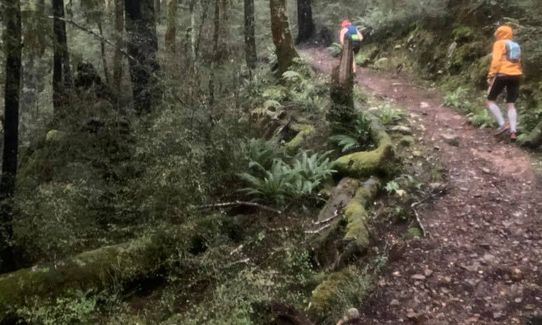
This is a lumpy, muddy, wet and slippery challenge. Be prepared for washouts, wet feet and some minor navigation. Don't be tempted to run this clockwise and, if possible, take a friend or a PLB. Painkiller is best tackled uphill as potential for a major tumble going downhill is very real. 

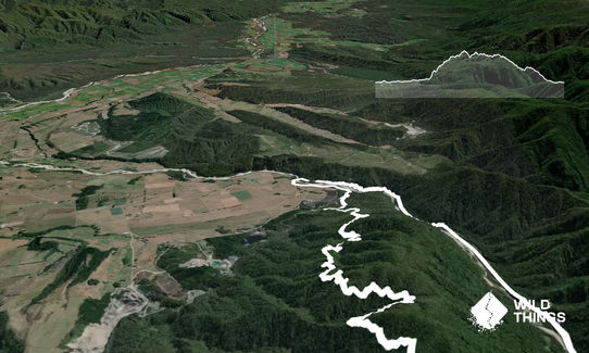
Just before the Waitahu River bridge (travelling from Reefton) turn right. 200m on left is a wooden gate entry to a new road/track. Follow this for about 1km, then turn right up a steep rocky roadway, 300m on the left is a goldpan on a marker with "Painkiller Track" on it. The trail is quite clear to follow, except for the two washouts. For the first (a creek), drop down to the creek then head upstream maybe 10 metres, then climb up to find the track. The second is a small slip. Follow the pink tape downhill, across the slip, and then back up to the track.

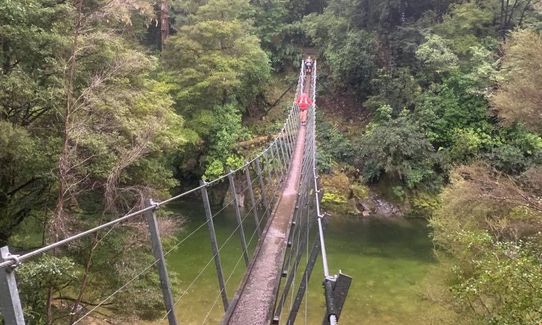
Once through the Painkiller, you'll hit the Inglewood intersection (just above the clearing with an old steam boiler). Head straight/left NOT right here. There is another sign (about 2k from the intersection) labelled "Devils Tail" that points up hill. Ignore it and continue downhill. Cross the swingbridge, turn left and follow the logging road back to Gannons Creek Bridge and your start point.

These are two old gold mining access roads that lead to the Inglewood Junction (with alternative exits to Blacks Point via the Machine Track).

If you know of any public toilets near the trail start or on the route, please login and then let us know so we can update this section.

Plenty of spots to park.

8 km

9 minutes

Unknown

No

Moderate.

Very patchy.

Thermal leggings, Long-sleeved thermal top, Seam-sealed waterproof jacket, Gloves, Beanie/thermal headwear, Personal Locator Beacon (PLB), Whistle, First aid kit, Extra food for emergencies, Cellphone, Map, Headtorch and spare batteries

No real water points except near the start/finish - so carry enough for 3-4 hours

Possible snow falls in winter, but will be wet underfoot year round.

Manuka stumps for the first climb, moss and tree roots until you get to Inglewood

Broadway Tea Rooms
31 Broadway, Reefton
http://www.thefuturedoughco.co.nz
Local bakery with good food and coffee

Berlins Cafe
Lower Buller Gorge, 30k from Westport
http://berlins.co.nz/

You and Painkiller Devil's Tail loop

As a VIP member you can record private notes for this trail, see all of your times and more.

Register Now

Already have an account? Login now

Trail Reviews

Be the first to submit a review for Painkiller Devil's Tail loop!

Login to submit a review

Trail Running Community

Find people who are interested in or have completed this trail run.

You must register or login to view this feature.

Register Now

Other trails nearby
Waiuta Ghost Town

Waiuta Ghost Town

Length: 23.7km

Level: Intermediate

Murray Creek and Devils Tail Revenge

Murray Creek and Devils Tail Revenge

Length: 14.4km

Level: Beginner

Montgomerie Hut via Gannons

Montgomerie Hut via Gannons

Length: 27.5km

Level: Beginner - Intermediate

Lankeys Creek Loop

Lankeys Creek Loop

Length: 8.5km

Level: Beginner

Find more trails and peaks nearby